iGeo 1996, Мултимедиен тест — Задача 2. Theme Water
1996 iGeo – The Hague, The Netherlands Multimedia Test - Questions
Условие
Theme Water
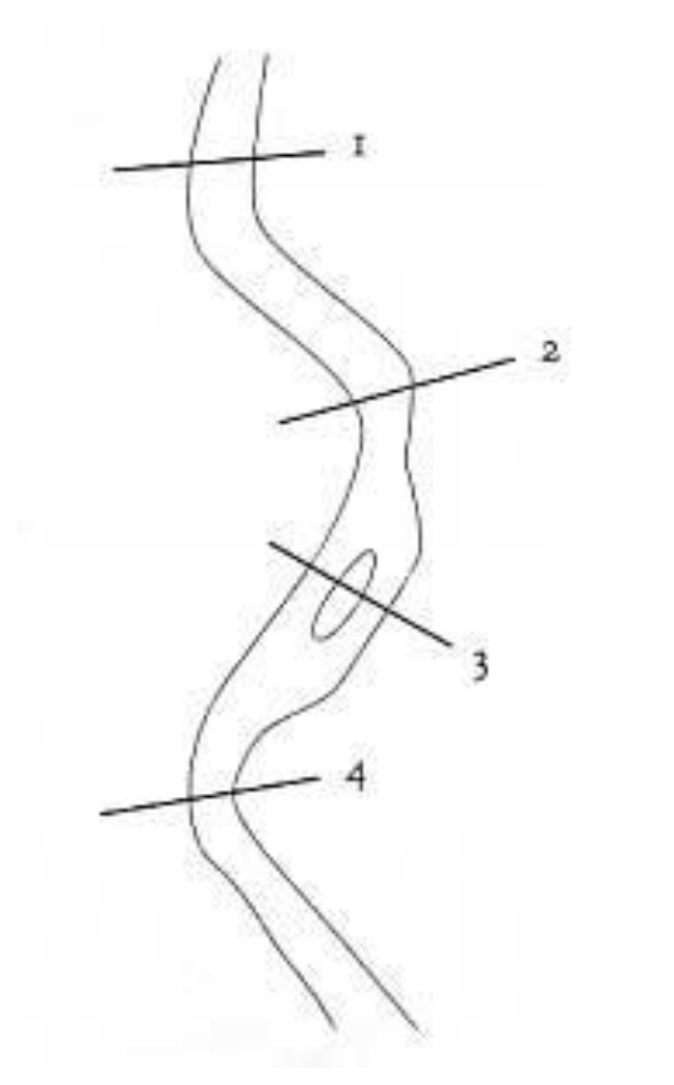
1. At which point can the river be most easily crossed? (analysing maps)
a. At 1
b. At 2
c. At 3
d. At 4
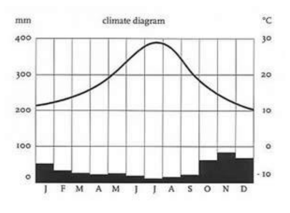
2. Which town does the climate diagram refer to? (analysing maps)
a. Los Angeles
b. Shanghai
c. Cape Town
d. Buenos Aires
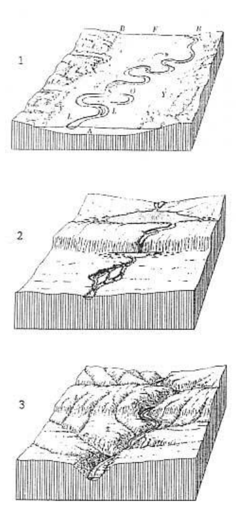
3. Which are the consecutive stages that a river goes through? (analysing maps)
a. 1,2,3
b. 1,3,2
c. 3,2,1
d. 2,3,1
Отговори
- 1. c
- 2. a
- 3. d
Решение
Theme Water
- c
- a
- d
Оригинал в Архива: 1996MMTquestions.pdf · официални решения: 1996MMTanswers.pdf