iGeo 1996, Писмен тест — Задача 17
1996 iGeo – The Hague, The Netherlands Written Test · 2 т.
Внимание: Бележка към темата
The archive file contains only Theme C (questions 17–20) of the six-theme written test; source C.1 (graphs) referred to in the questions is not included in the file.
Instructions for the contestant
This test consists of 6 themes. Each theme contains a number of questions. The number of marks you can gain for a correct answer is given for each question. The maximum number of marks is 100. Do not give more answers (reasons, examples, etcetera) than is requested. For example, if two reasons are asked and you give more than two reasons, only the first two are taken into account. Any question that calls for an explanation or a commentary will only gain marks if the answer contains such explanation or comment. Write all the answers with the corresponding numbers on your answering sheet. Use a new answering sheet for each theme. You have three hours to complete this test.
Good luck!
Условие
Theme C: The water cycle
Location: Lake Aral
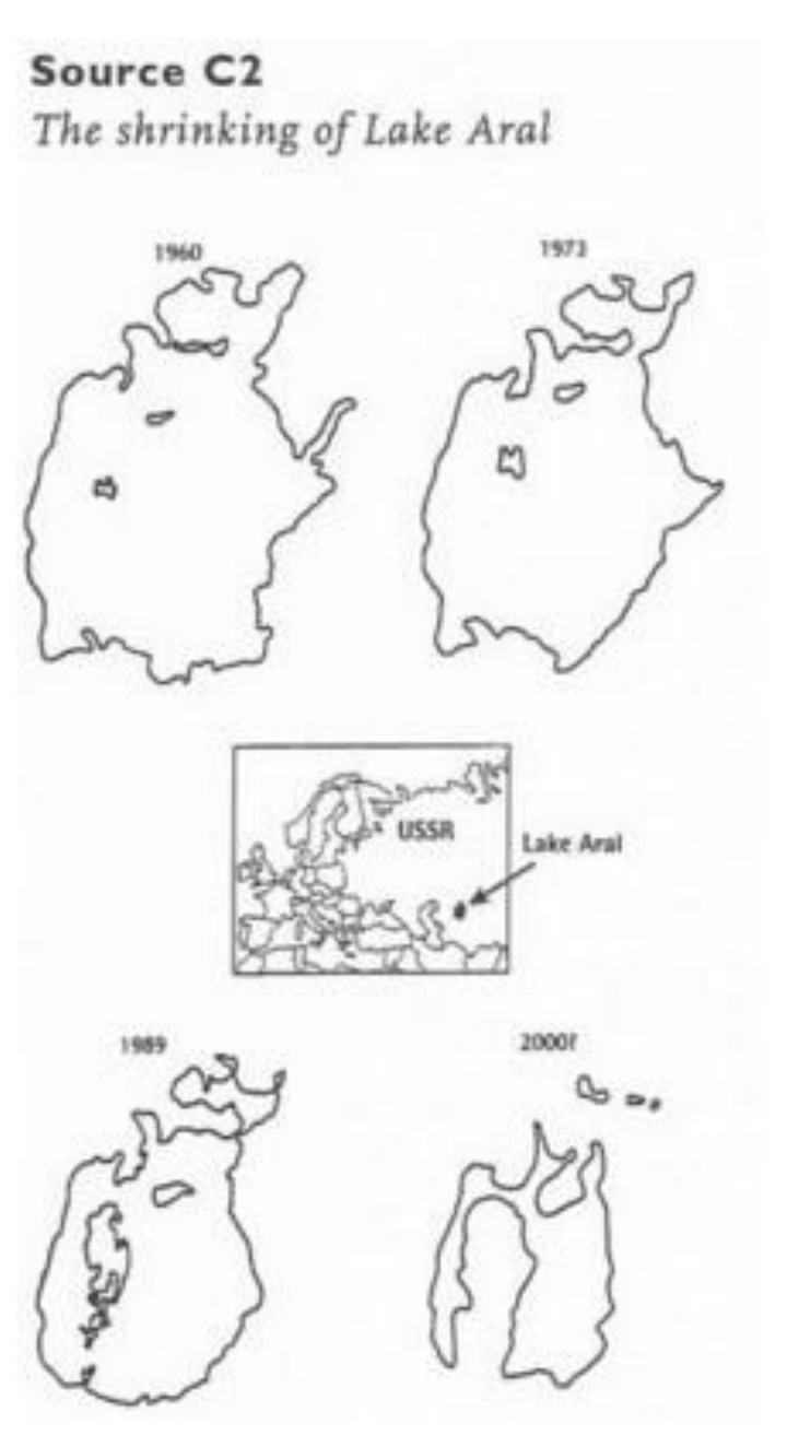
Study the maps of the subsiding lake Aral in source C.2. and the graphs in source C.1.
Because of what human activity has lake Aral subsided? (2 marks)
Решение
Внимание: Непълно решение
В архива няма официално решение на тази задача.
Оригинал в Архива: 1996WrittenTest.pdf