iGeo 2013, Мултимедиен тест — Задача 3. Q3
iGeo 2013 · Multimedia Test
Внимание: Бележка към темата
The archived PDF supplies static frames for Q13, E16 and Q31, and a black movie viewport for Q34. Motion originals and a blank response sheet are unavailable. The official key contains answer letters only. Native E16 and “biomass types” are retained.
Условие
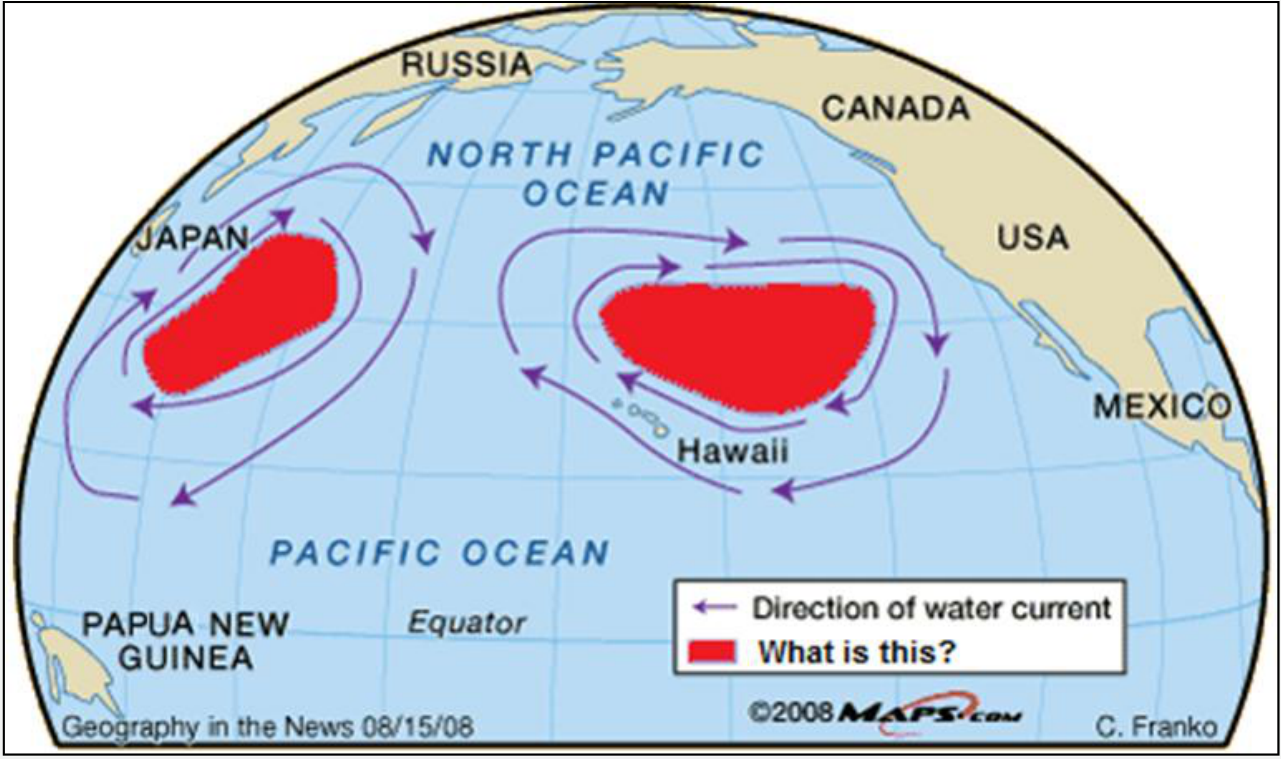
What do the red areas in the map represent?
A. zones of high levels of chlorophyll concentration
B. the estimated coverage of the Great Pacific garbage patch
C. zones of low mean annual sea surface temperature
D. feeding grounds of several whale species
Отговори
- B
Решение
ANSWER CODE: B
Оригинал в Архива: 2013MMT.pdf · официални решения: 2013MMTAnswers.pdf