iGeo 2013, Писмен тест — Задача 26. Section E: Climate Change in Sudan — Question 6
10th International Geography Olympiad — Kyoto, Japan — 30 July – 5 August 2013 — Written Response Test — Question and Answer Booklet · 30 юли 2013 г. · 2 т.
Корица
Do NOT open the Booklet before instructed to do so by a supervisor.
Name: … Team: …
Student number: …
Instructions for the Students
- Fill in your name, team and iGeo student number on the front page of this Question and Answer Booklet.
- Fill in your iGeo student number in the boxes on top of the pages in this Booklet.
- This test consists of 6 Sections.
- The maximum total mark is 90. The mark for each question is given at the beginning of the question.
There are a maximum of 15 marks for each Section. - Answer all questions in the spaces provided in this Booklet.
- Check the backs of pages as questions are printed on both sides of a page.
- Give only the required number of answers (reasons, examples, etc.). For instance, if the question asks for 2 reasons and you give more than 2, only the first 2 reasons will be marked.
- You must use the Diercke International Atlas during the test where referred to in the questions and at your convenience.
- The Resource Booklet contains Sources referred to in the questions.
- You may use a calculator during the test.
- Time: 180 minutes for students not educated in English, 150 minutes for students educated in English.
- Students not educated in English are allowed to use bilingual dictionaries during the test.
Good luck!
Instructions for the Markers
- Check if the iGeo Student Numbers are on each sheet before dividing up the paper.
- This test consists of 6 Sections.
- One whole Section per marker and double-checker.
- Check whether the answer continues outside designated area. No credits will be given to answers in the Resource Booklet.
- The maximum total mark is 90. The mark for each question is given at the beginning of the question.
There are a maximum of 15 marks for each Section. - Get the hang of the full range of answers by reading through a few papers with your co-marker before you start your marking.
- These answers are not exhaustive. Credit any relevant answer.
- Mark only the required number of answers (reasons, examples, etc.). For instance, if the question asks for 2 reasons and there is more than 2, only the first 2 reasons will be marked.
- Put your mark next to the question number in the column on the left – it eases the work of the person who has to put the numbers into MS Excel. Total the marks by the title of the Section.
- Usually whole marks with only these exceptions: A1, B1, C3, E6.
- The Moderators (Sue and Anu) will sample the marking of all teams.
Условие
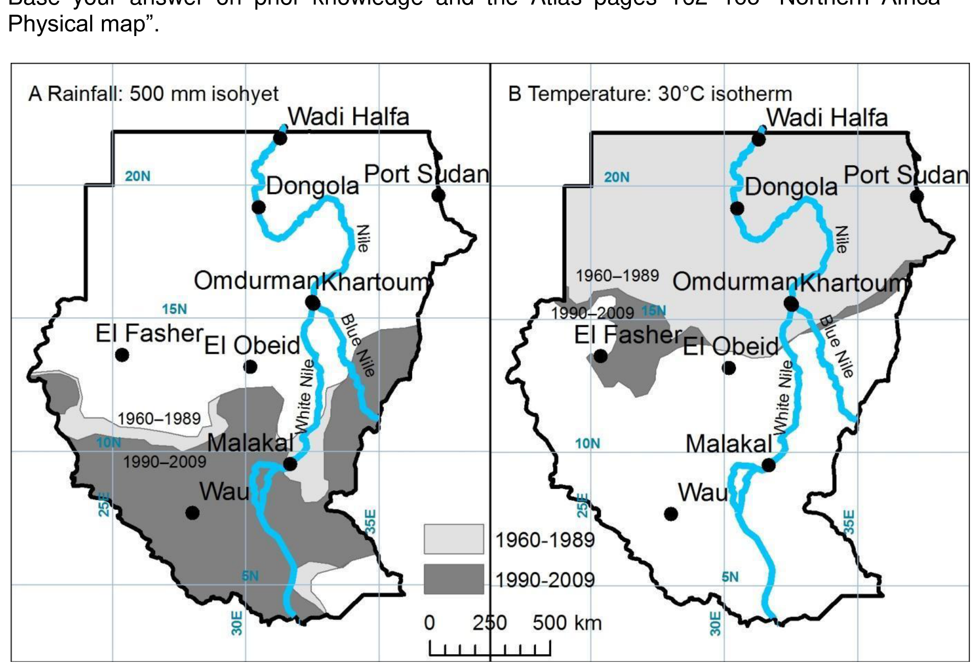
Study Resource Booklet Source E2 the climate change maps of Sudan.
Using the black-and-white maps below:
a) Sketch on Map A – your prediction for the location of the 500 mm rainfall isohyet for the period 2010–2039 if the trends continue.
b) Sketch on Map B – your prediction for the location of the 30°C isotherm for the period 2010–2039 if the trends continue.
Base your answer on prior knowledge and the Atlas pages 162–163 “Northern Africa – Physical map”.
Решение
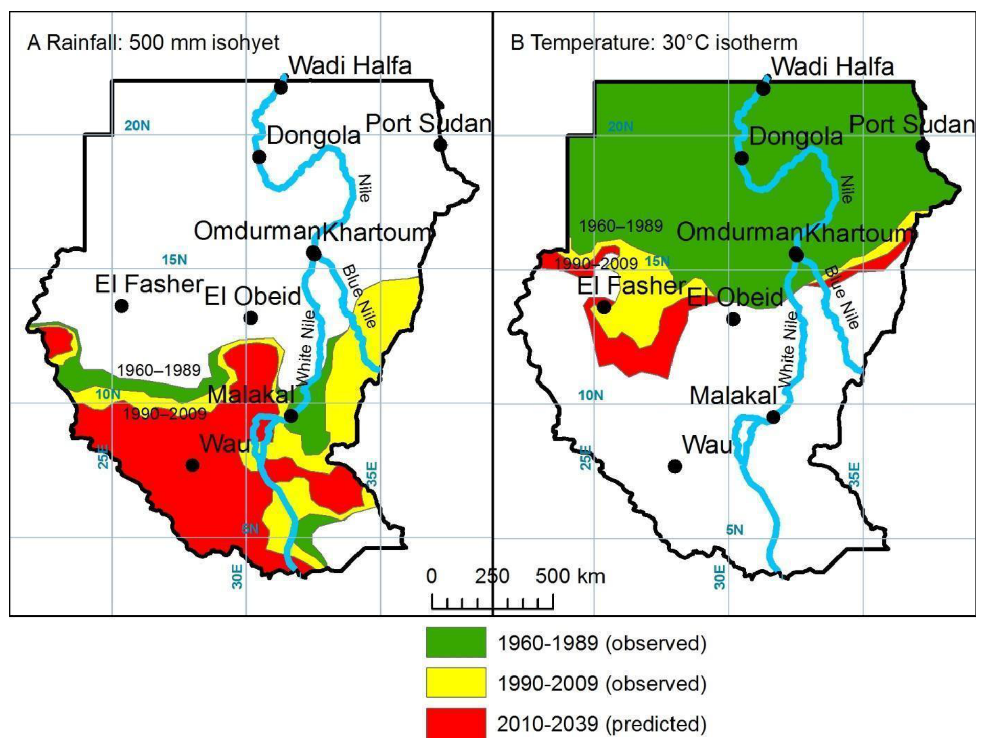
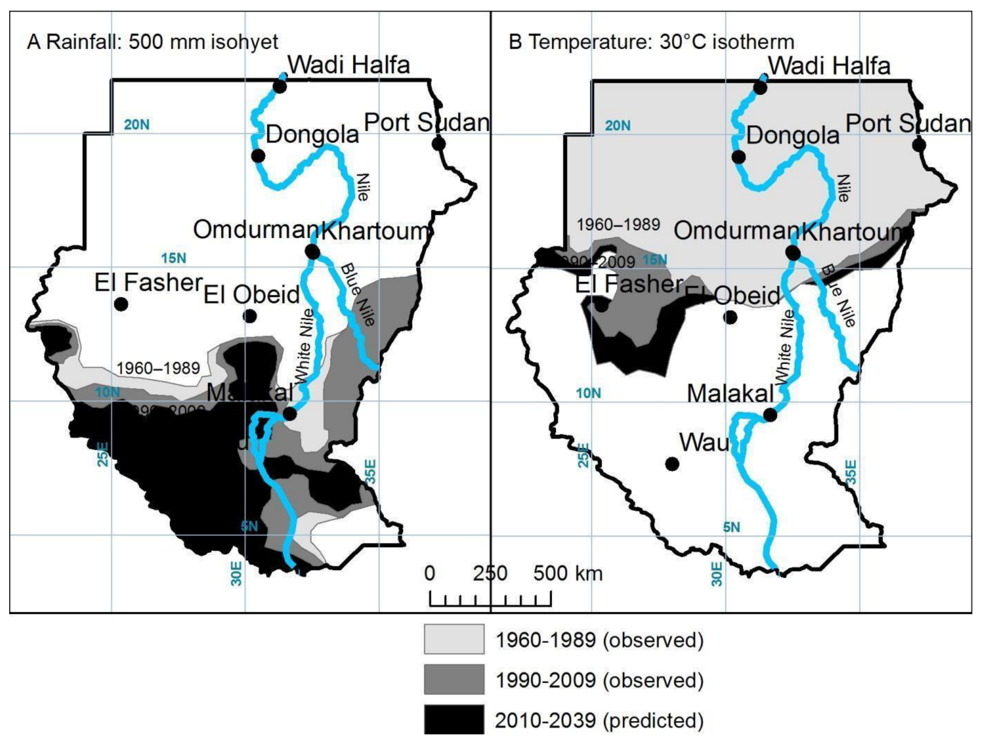
Answer: 2 marks: 1 mark for isohyets, 1 mark for isotherm.
It will be visual judgement for quite generalised lines but half marks may be awarded for lines that approximate to the actual lines.
For the isolines the areas have to:
- ‘Move’ towards the right direction,
- Follow some topography (hills, mountains, river valleys),
- Have an isohyet in south-western part of the country,
- Separate isohyets for Darfur region,
- Excellent if student could consider the uneven time periods:
NB! 1960–1989 is 29 years
1990–2009 is 19 years
2010–2039 is 29 years.
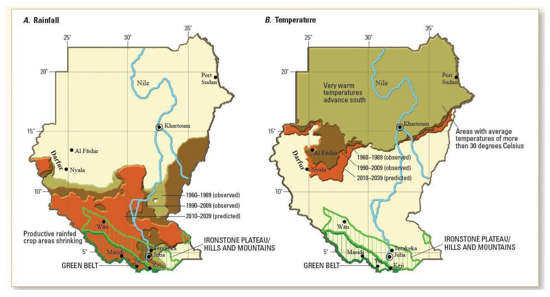
Original: figure 1 Source: ‘A Climate Trend Analysis of Sudan’: http://pubs.usgs.gov/fs/2011/3072/pdf/FS2011-3072.pdf (see below).
Оригинал в Архива: 2013KyotoWRTQuestionAndAnswerBooklet.pdf · официални решения: 2013KyotoWRTMarkingScheme.docx