iGeo 2014, Мултимедиен тест — Задача 31. Q31
iGeo 2014 · Multimedia Test
Внимание: Бележка към темата
The official key supplies answer letters only. A blank response sheet and explanatory solutions are unavailable. Original movies and browser-compatible copies are linked for Q36 and Q38; the original PDF viewports are also retained.
Условие
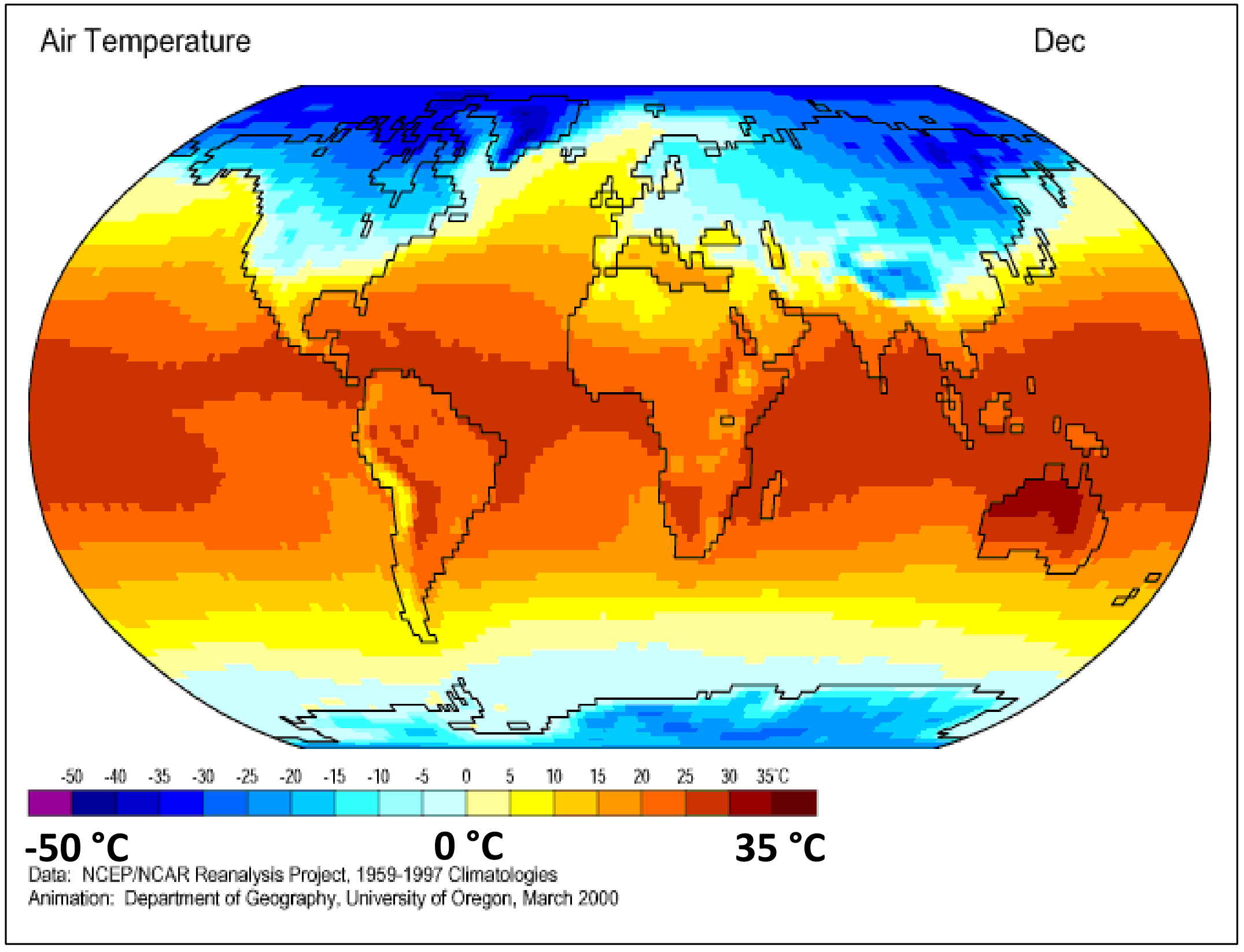
Which factor is the most important to explain the temperature differences shown in this map?
A. continentality
B. Earth’s rotation
C. latitude
D. ocean currents
Отговори
- C
Решение
ANSWER CODE: C
Оригинал в Архива: 2014MMtest.pdf · официални решения: 2014MManswercodes.pdf