iGeo 2015, Теренна работа — Задача 1.3. Land use in Moon Valley in 2015
Land use in Moon Valley in 2015 · 4 т.
Бележка от източника
The official marking review refers to a Local Organising Committee assessment map, but that model map is not included in the archived task, guidance or marking review. The complete printed task-specific marking instructions are retained. The task requires on-site observations.
Условие
TIME LIMIT 30 MINUTES. 4 MARKS MAXIMUM
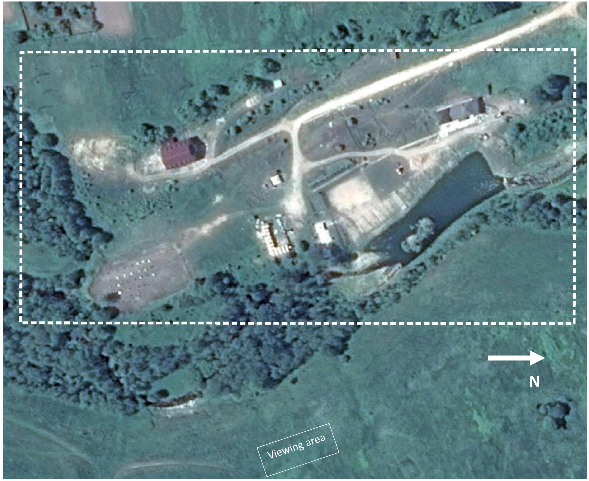
From the viewing area, observe ‘Moon Valley’ (a recently created facility providing accommodation, fishing and other recreational activities). Draw a land use map of the area highlighted on the satellite image on the right.
The map should contain general features such as paths, streams, etc. The key should contain descriptions of a minimum of six land uses identified in this part of Moon Valley.
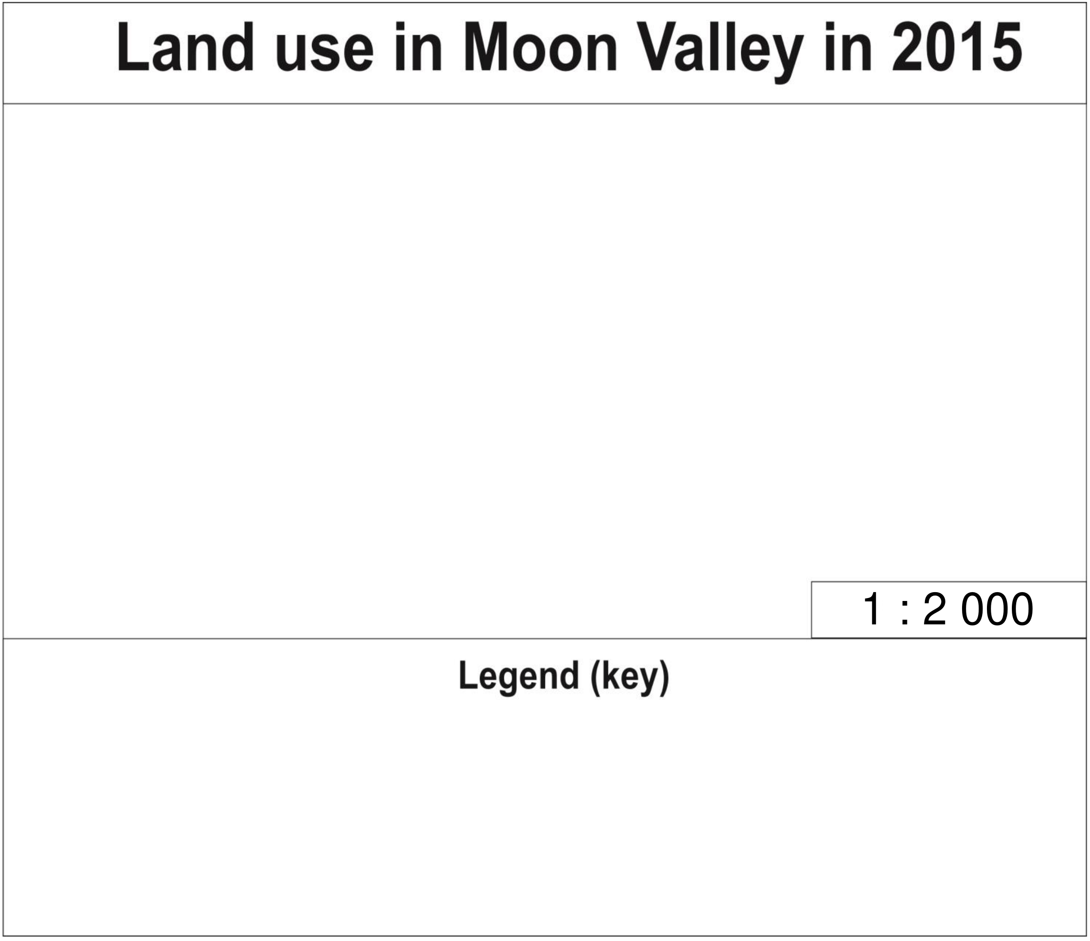
Draw your map on the template with the title Land use in Moon Valley in 2015. The locational accuracy and size of features will be assessed, along with the use of symbols and descriptive text reported in your key.
You may use your compasses.
GUIDANCE FOR FWE 1
IGEO 2015 FIELDWORK 1
| Name | Number | Team |
|---|---|---|
| __________________ | __________________ | __________________ |
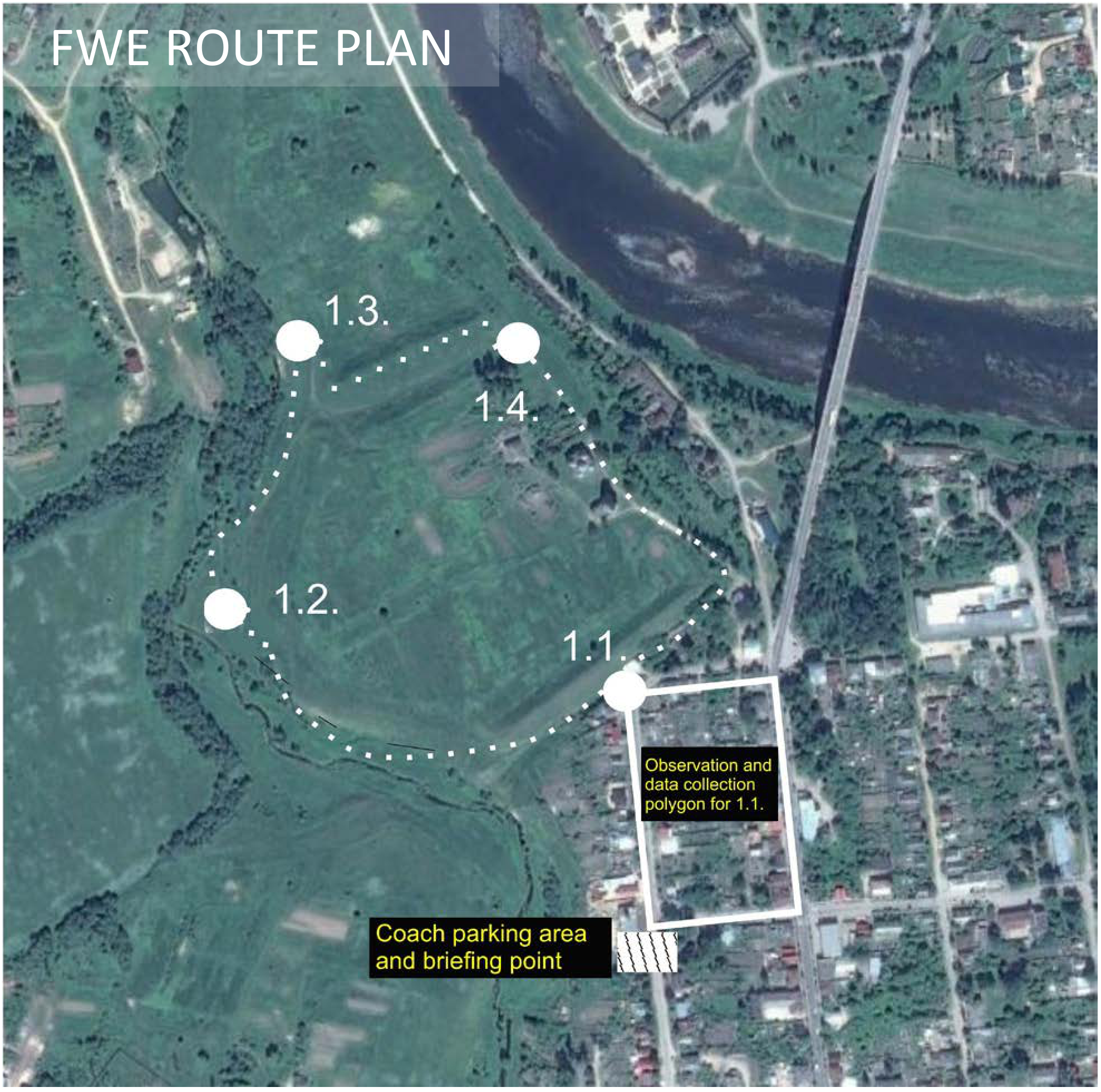
You are now in the central part of Staritsa, an historical settlement of the Tver oblast. Staritsa will be the venue for today’s field exercise. Please read the following notes carefully and follow all the instructions provided. Start by completing the header of this sheet with your personal data (given and family names, student number and team). Today’s exercise consists of four stages and you have to pass through all stages in order. For the exercise, you will work in groups of 40 participants, all from different countries. Do not attempt to change groups. Remain with your group at all times; volunteers will guide you, and you must follow all their instructions. If you have any sort of emergency, please ask for help from the volunteers. You may make additional notes in the space provided on the back of this sheet before you leave each stage. At each stage, you will receive a task sheet to complete and instruments to use (if necessary). At each stage you have 5 minutes to complete the front sheet and read the task, and then 30 minutes for observations and completing your answer. Please note that mobile phones, tablets or other means of communication are strictly prohibited during fieldwork. All violations of this rule will result in a penalty score. Take care at all times in the field; stay away from dangerous slopes.
FWE ROUTE PLAN
PLEASE USE THE OTHER SIDE OF THIS SHEET FOR YOUR INDIVIDUAL NOTES
INDIVIDUAL NOTES
Решение
Внимание: Непълно решение
The official marking review refers to a Local Organising Committee assessment map, but that model map is not included in the archived task, guidance or marking review. The complete printed task-specific marking instructions are retained. The task requires on-site observations.
FWE1/3 (marked out of 4)
Marking jury: Mariana Soultanova and Hana Svobodova
The Local Organising Committee provided the map used for assessment. The marking instructions were as follows.
Each mapped landuse that was located reasonably accurately and described appropriately in the legend scored 0.5m up to 3 marks. Once a student has 6 sites identified correctly, the marker stop assessing.
There was 1 mark allocated for mapping. If the field drawing had areas with clearly defined boundaries, and there was effective/appropriate use of symbols, the marker gave 1.0. If there was evidence of confusion and symbols were inappropriate (e.g. red used to outline/symbolise vegetation and/or the pond) but the map was still clear, then .5. For poorly produced maps that still have six features shown, then 0.
Comments: generally the most successful FWE1 exercise, showing most students have been taught or alerted to the need to map clearly in the Olympiad tests. Highest average mark with a low standard deviation.
Statistics
| Min | Max | Mean | Std |
|---|---|---|---|
| 0.0 | 4.0 | 2.71 | 0.81 |
Оригинал в Архива: 2015FWE1task3.pdf · официални решения: 2015FWEMarking.pdf · допълнителни данни: 2015FWE1guidance.pdf