iGeo 2015, Теренна работа — Задача 1. Task 2.1. Staritsa’s changing zone of influence
12th International Geography Olympiad. FIELDWORK EXERCISE 2. Staritsa and sustainable settlement systems (Tasks 2.1 - 2.3). Tver 2015 · 6 т.
Указания
All tasks must be completed individually, using the answer templates provided.
The Resource Book provides important supporting materials.
Time management:
- You may have ten minutes to read the paper and Resource Book. No writing in this time.
- Students with English as the language of instruction then have two hours to complete the test.
- All other students have two hours and 20 minutes.
Write your answers in pen.
You may use coloured pencils/pens for map work or diagrams.
You may refer to material in the Resource Book in your answers, and you may use material included in earlier answers you have provided.
Условие
Task 2.1. Staritsa’s changing zone of influence (maximum 6 marks).
In the last 150 years, Staritsa (established in 1297) has had a declining zone of influence as three other settlements in the southern Tver oblast (region) have grown much more rapidly for a variety of reasons. Rzhev and Torzhok, for example, have much better transport linkages and Tver is on major road and rail links as well as having been a regional administrative centre for several centuries.
Statistical data (page 5 in Resource Book) includes the size of the population in each of these centres at two important points in history (1867 and 2015). If population dynamics reflect the economic development of settlements in the region, we can make a map that shows the relative change in Staritsa’s zone of influence.
Using Map Template 1, and the processes used in the Gravity Model (Resource Book, pages 6-7) map the change in the polygon that shows Staritsa’s zone of influence between 1867 and 2015 (use contrasting line symbols with clear labels). The data you need to make the map is given in the Resource Book (page 5).
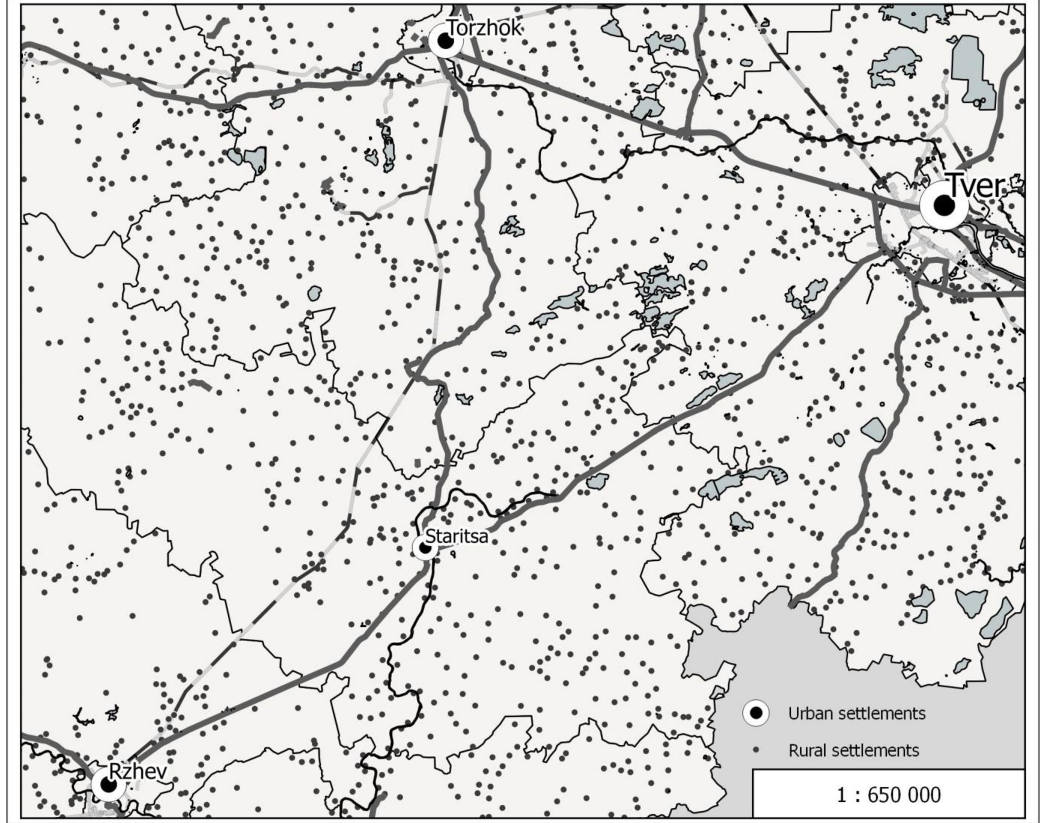
The map shows changes that influence the sustainability of Staritsa.
Approximately how much did the Staritsa zone of influence change in size between 1867 and 2015? Provide a percentage estimate with a plus or minus sign as appropriate.
______ %
Отговори
-85 %
The marking review gives the worked figure as a reduction of 85%; any estimate within 10% of it, expressed as a negative change, received 2 marks, and within 20% received 1 mark.
Решение
FWE2/1 (marked out of 6)
Marking jury: Milton Brown and Ivan Čanjevac
A drawn model was prepared for the markers, but the use of a cut out shape (made by the markers) was found to be more efficient in the marking process. The convener of the marking jury in consultation with the DoT decided not to award marks for estimates of change in zone of influence where there was no evidence that the student had made and used the model to arrive at the estimate.
- Two marks were for each of the polygons (1867 and 2015), with 1 mark for right shape (an irregular polygon with Staritsa at its centre) and 1 mark for size determined by the location (within 5mm) of each vertice. For each zone of influence polygon, the marks available were 2, 1.5, 1 and .5.
- Two marks were allocated to the estimated change in the zone of influence. Students used calculated the areas of the two polygons and show the area of the 2015 polygon as a proportion of the 1867 polygon. Any estimate within 10% of the worked figure (85%) was given 2 marks, provided it was expressed as a negative change in the zone of influence. Any estimate within 20% of the figure got 1 mark, provided it was expressed as a negative change in the zone of influence. No marks for estimates that showed an increase in the zone of influence, or reported values of more than 20% greater or smaller than the figure in the worked model.
Comments: Quite a few students did not score or did not attempt this question, but those who worked through the exercise on the basis of the resource material often scored 5 or 6 full marks (59 students). The bimodal mark distribution led to a high standard deviation for this task.
Statistics
Min 0.0 Max 6.0 Mean 3.03 Std 2.50
Оригинал в Архива: 2015FWE2task.pdf · официални решения: 2015FWEMarking.pdf