iGeo 2015, Мултимедиен тест — Задача 18. Q.18
Multimedia Test Tver, Russia
Указания
This test has 40 questions.
Look at every page and read the questions carefully.
You have 45 minutes to complete the test. If you finish early wait silently until the 45 minutes are over.
Each question is multiple-choice. Choose A, B, C or D. Only one answer is correct.
Some questions contain a short video clip (indicated with [film-reel icon]). Click inside the video frame to start it.
Mark your choice on the Answer Sheet by making a circle around the letter that you want to select. If you make a mistake cross out the selected letter and circle a new choice.
For navigation it is best to use the arrows on the keyboard to move to the next (↓ →) or previous (↑ ←) page. DO NOT CLICK ON THE ESCAPE BUTTON, AS THAT ENDS THE PRESENTATION.
Good luck!
Условие
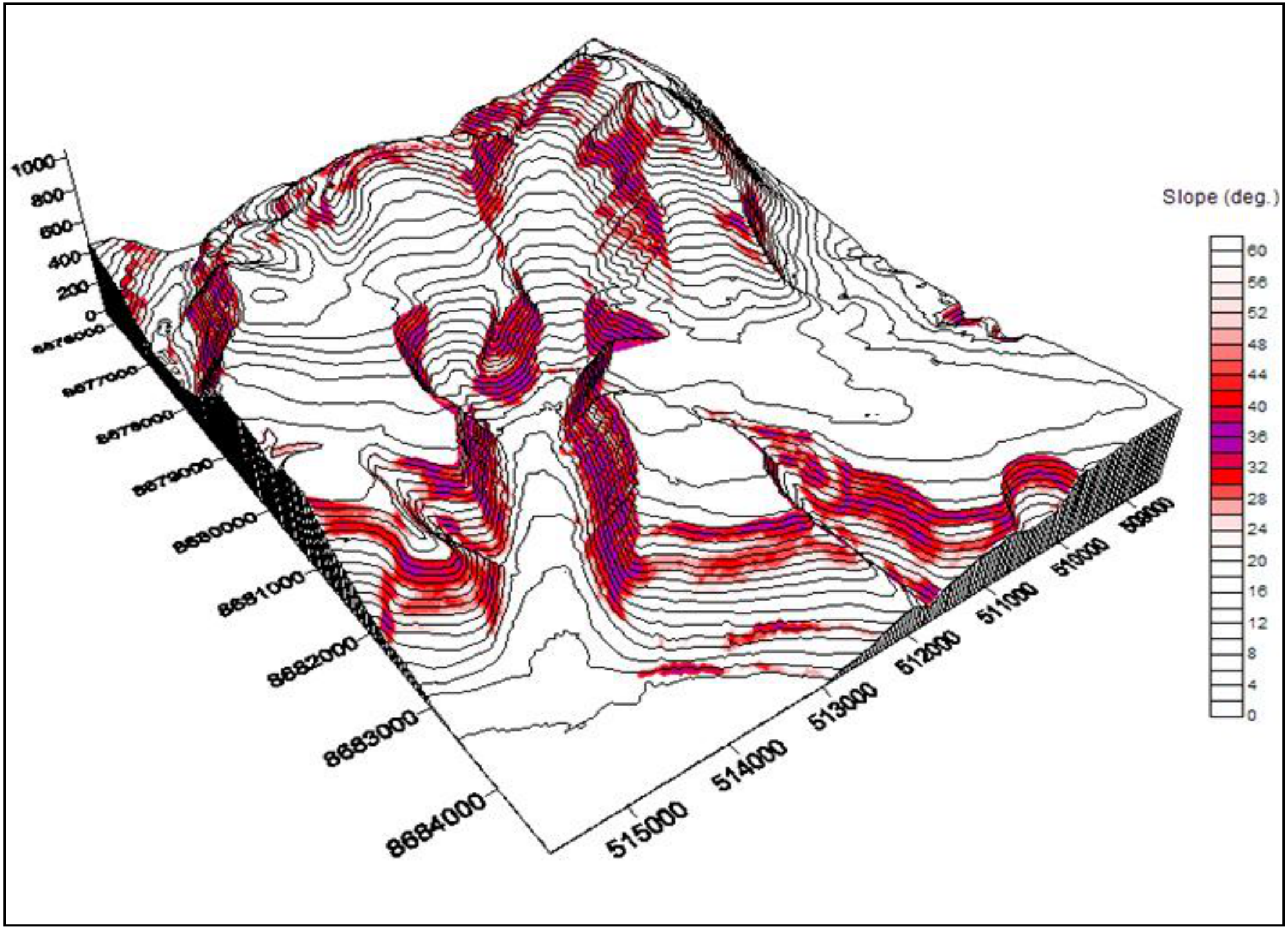
The coloured areas in the 3D model represent places that:
A. are at greatest risk of avalanches
B. are at greatest risk of earthquakes
C. receive the highest rainfall in winter
D. receive more solar radiation in summer
Отговори
- A
Решение
Question 18: A
THE END
You have reached the last slide of the Multimedia Test.
Click on the arrow ↑ or ← to go back to the previous page(s) if you want to check your answers
OR
wait silently until the time is over.
Оригинал в Архива: 2015MMtest.pdf · официални решения: 2015MManswercode.pdf