iGeo 2016, Мултимедиен тест — Задача 17. Question 17
iGeo 2016 · Multimedia Test
Внимание: Бележка към темата
Native red highlights supply the answer letters, without worked explanations. Four movie-dependent questions retain full original slides/posters/icons; movie sequences and soundtracks are absent from the obtained archive packet and have not been read. Q38 choices C/D and red C are recovered from exact original PDF objects beneath its source-authored map overlap; the complete unmodified page is preserved.
Условие
Q.17
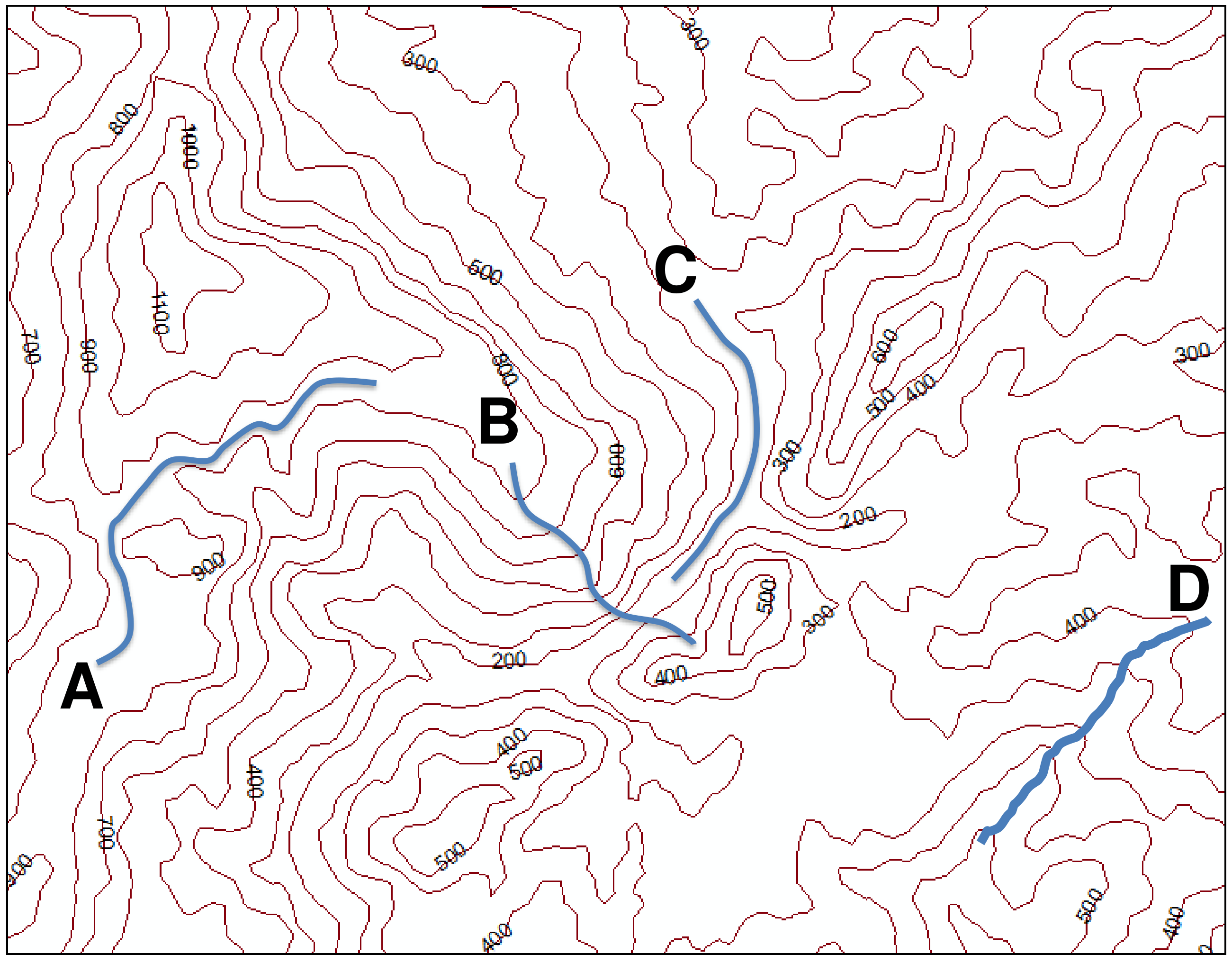
Which line (A, B, C or D) represents part of a river?
A. A
B. B
C. C
D. D
Отговори
- C
Решение
Native red highlighted answer: C
Оригинал в Архива: 2016MMtest.pdf