iGeo 2016, Мултимедиен тест — Задача 19. Question 19
iGeo 2016 · Multimedia Test
Внимание: Бележка към темата
Native red highlights supply the answer letters, without worked explanations. Four movie-dependent questions retain full original slides/posters/icons; movie sequences and soundtracks are absent from the obtained archive packet and have not been read. Q38 choices C/D and red C are recovered from exact original PDF objects beneath its source-authored map overlap; the complete unmodified page is preserved.
Условие
Q.19
Von Thünen's 1826 model of agricultural land use assumed that the city is located centrally within an “isolated state”. What does the second (blue, 2 to 5 km) area correspond to?
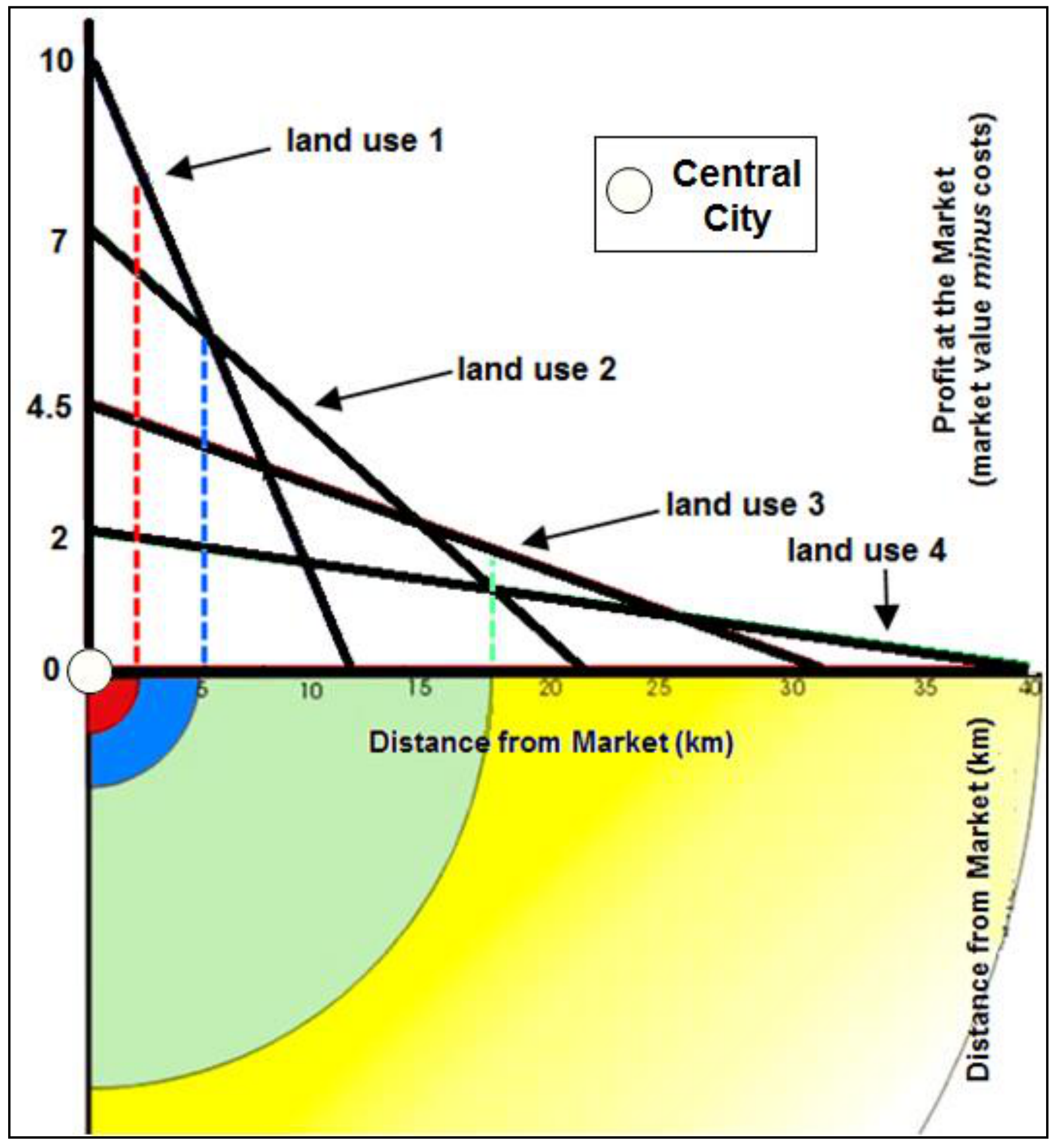
A. dairy and market gardening
B. forestry for fuel
C. grains and field crops
D. ranching
Отговори
- B
Решение
Native red highlighted answer: B
Оригинал в Архива: 2016MMtest.pdf