iGeo 2016, Мултимедиен тест — Задача 38. Question 38
iGeo 2016 · Multimedia Test
Внимание: Бележка към темата
Native red highlights supply the answer letters, without worked explanations. Four movie-dependent questions retain full original slides/posters/icons; movie sequences and soundtracks are absent from the obtained archive packet and have not been read. Q38 choices C/D and red C are recovered from exact original PDF objects beneath its source-authored map overlap; the complete unmodified page is preserved.
Условие
Q.38
The map shows average cloudiness between 2002 and 2015. What is one reason for high levels of cloud cover?
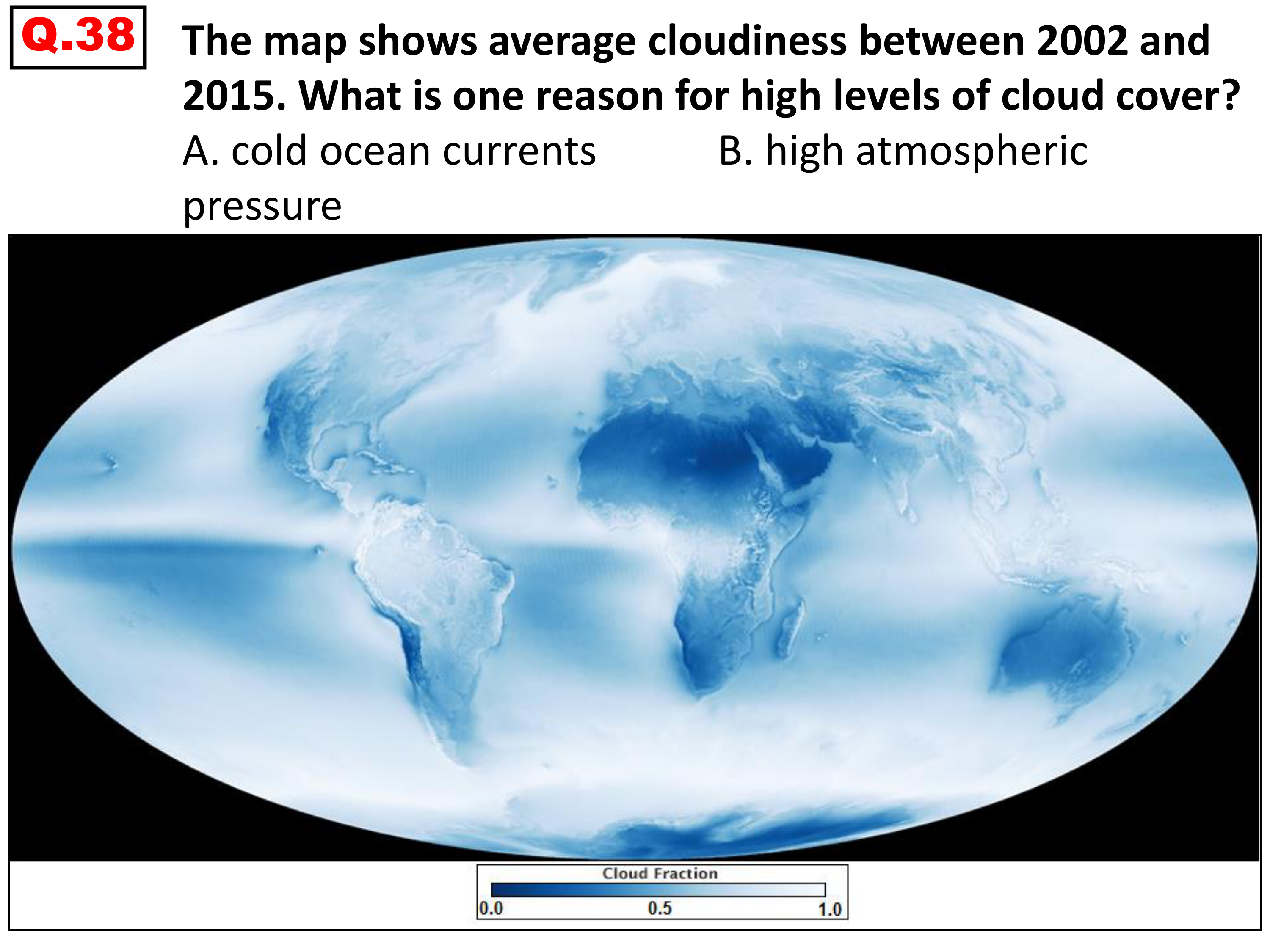
A. cold ocean currents
B. high atmospheric pressure
C. convergence of trade winds
D. downslope winds
Source note: In the original exported PDF, the cloud map overlaps choices C and D and the red answer. The selectable C/D wording and code C above are recovered from the exact original PDF text and color objects; an explicitly labelled diagnostic copy exposes those unchanged objects by hiding only the covering map image. The complete unmodified original page is retained here. No scientific answer has been inferred.
Отговори
- C
Решение
Native red highlighted answer: C
The original PDF encodes choice C in red, but its map covers the choice in the exported layout. Exact original text/color-object recovery is documented in the source note; no worked explanation is printed.
Оригинал в Архива: 2016MMtest.pdf