iGeo 2017, Теренна работа, упражнение 1, задача 1C — Задача 2. C2.
14th International Geography Olympiad. FIELDWORK EXERCISE 1. Task 1C. Belgrade, 2017 · 2 т.
Указания
DURATION 15 MINUTES. TOTAL 6 MARKS
You are now at the Stop S4. Use your position as an observation point over Belgrade. Remember this panoramic view for tomorrow’s exercise (FWE-2). Complete the following tasks.
Условие
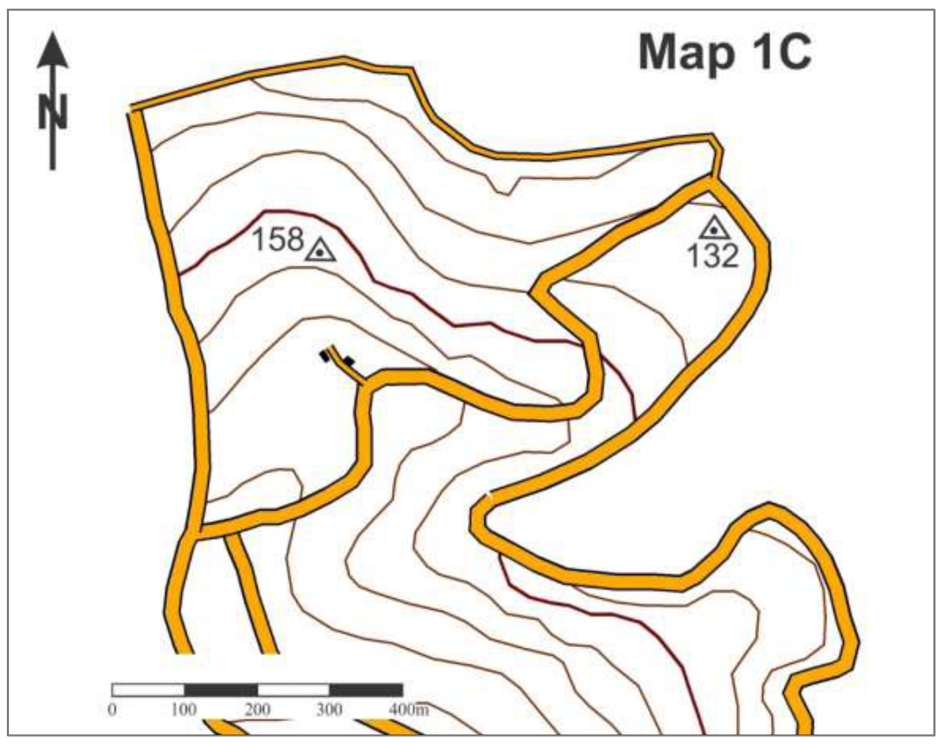
You are standing near the upper point of a mountain ski run. Using Map 1C, calculate the inclination of this slope (degree, or percent). (2 m)
Place for calculations. Please show all of your work
Answer: Slope inclination – ________________ (please, indicate the unit – degree, or percent)
Решение
Внимание: Непълно решение
В архива няма официално решение на тази задача.
Оригинал в Архива: FIELDWORK 1 TASK 1С.pdf