iGeo 2019, Теренна работа, задача 2 — Задача 2.3
16th International Geography Olympiad. Hong Kong, China. 30 July – 5 August 2019. FIELDWORK EXERCISE. Task 2 · 30 юли 2019 г. · 6 т.
Fieldwork Task 2: Question paper — Transportation and the promenade
Time allowed: 75 minutes. Complete questions 2.1 to 2.5. [Total score: 30]
This question paper and its appendix contain a total of 8 pages.
You are now at point PtB (see Map 1b). At the end of this session, submit your question paper at station ST3 (see Map 1b, Figure B4, at a pavilion overlooking the public pier). Make sure you have written your name and student number in the spaces provided on the question paper. Late submissions will not be accepted.
At fieldwork sites F1 to F3, and along the promenade (Green line; Map 1b), collect data and answer the following questions:
Условие
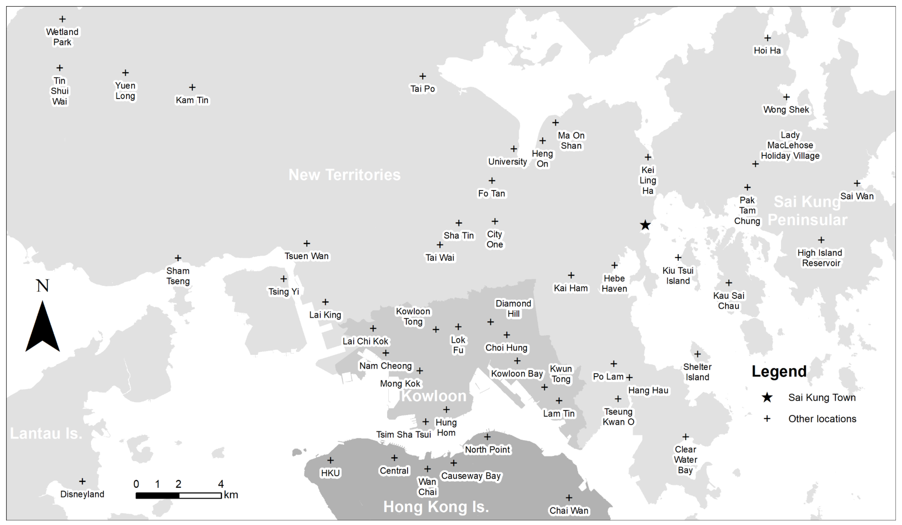
On Figure B2, properly display the end terminals of various modes of public transport which are linked to Sai Kung Town. (6 marks)
Решение
Внимание: Непълно решение
В архива няма официално решение на тази задача.
Оригинал в Архива: FWE_Task2_QP.pdf