iGeo 2021, Теренна работа, част II — Задача 2.3. Task 2.3 - Mapping and annotation
17th International Geography Olympiad, Istanbul, Turkey, 10-16 August 2021 — Fieldwork Exercise Part II — Tasks and Resources · 10 август 2021 г. · 4 т.
Условие
The satellite image on the left shows the area near Haciosman metro station (the northern terminal of the M2 metro line, opened in 2011 to serve neighbourhoods in Sariyer). Draw a land use map of the highlighted area (the blue rectangle box) shown in the satellite image. The land use map should contain different types of land use in the built-up area and non-built-up area. In addition, you are required A) to classify the residential housing shown in the highlighted area into at least two different types and B) to classify the non-built-up area into two different types. A key and the rationale (reasons for) your classifications should also be provided.
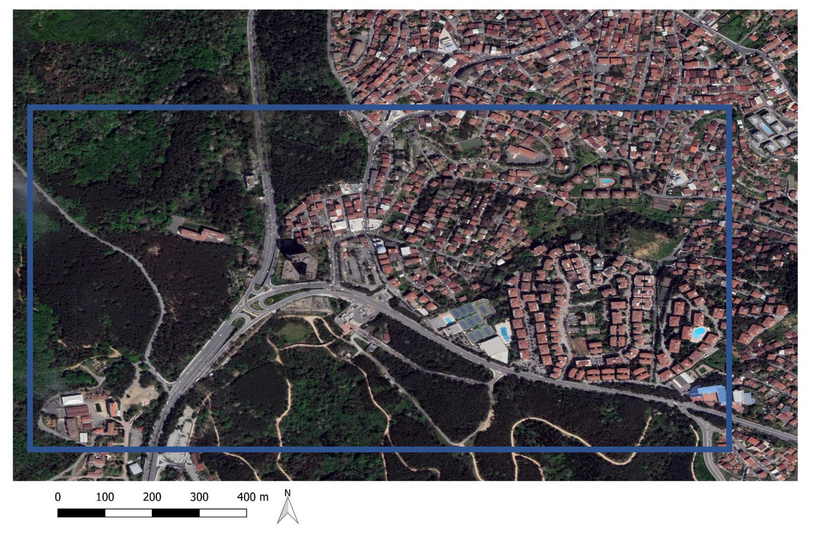
Draw your map on the response sheet. The locations, accuracy, size of features, residential housing classification, key and use of symbols will be assessed. Provide your rationale for A) and B) in the response sheet.
Решение
Внимание: Непълно решение
В архива няма официално решение на тази задача.
End of Fieldwork Exercise Part II
Authors of FWE Part II: Alice S.Y. Chow, Alexey Naumov, Eyup Artvinli
Sources of information:
- Google Map, Google Earth Pro
- OpenStreet Map
- Endeksa Teknoloji A.Ş. (real estate data analytics platform) (https://www.endeksa.com/en)
Оригинал в Архива: iGEO_2021_FWE_II Tasks and resources.pdf