iGeo 1996, Мултимедиен тест — Задача 1. Theme Maps
1996 iGeo – The Hague, The Netherlands Multimedia Test - Questions
Условие
Theme Maps
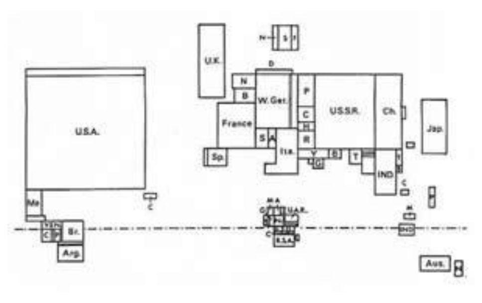
1. What is shown in this diagram? (analysing diagrams)
a. Gross national product
b. Oil production
c. Agricultural production
d. Number of inhabitants
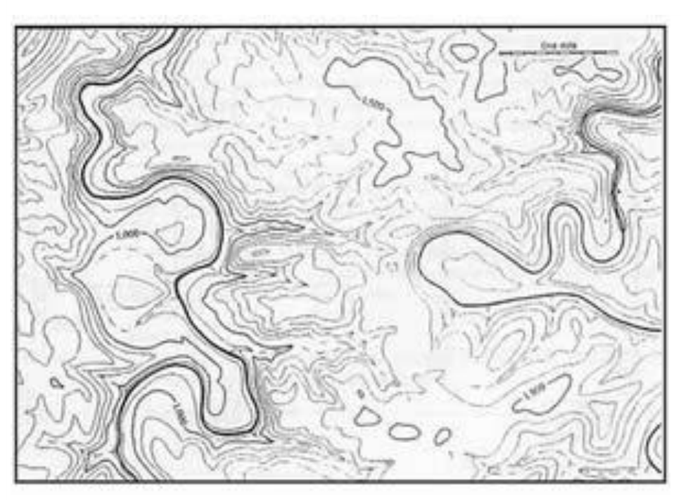
2. Which is the best characterisation of this landscape? (analysing maps)
a. Plain
b. Table land
c. Low mountains
d. High mountains
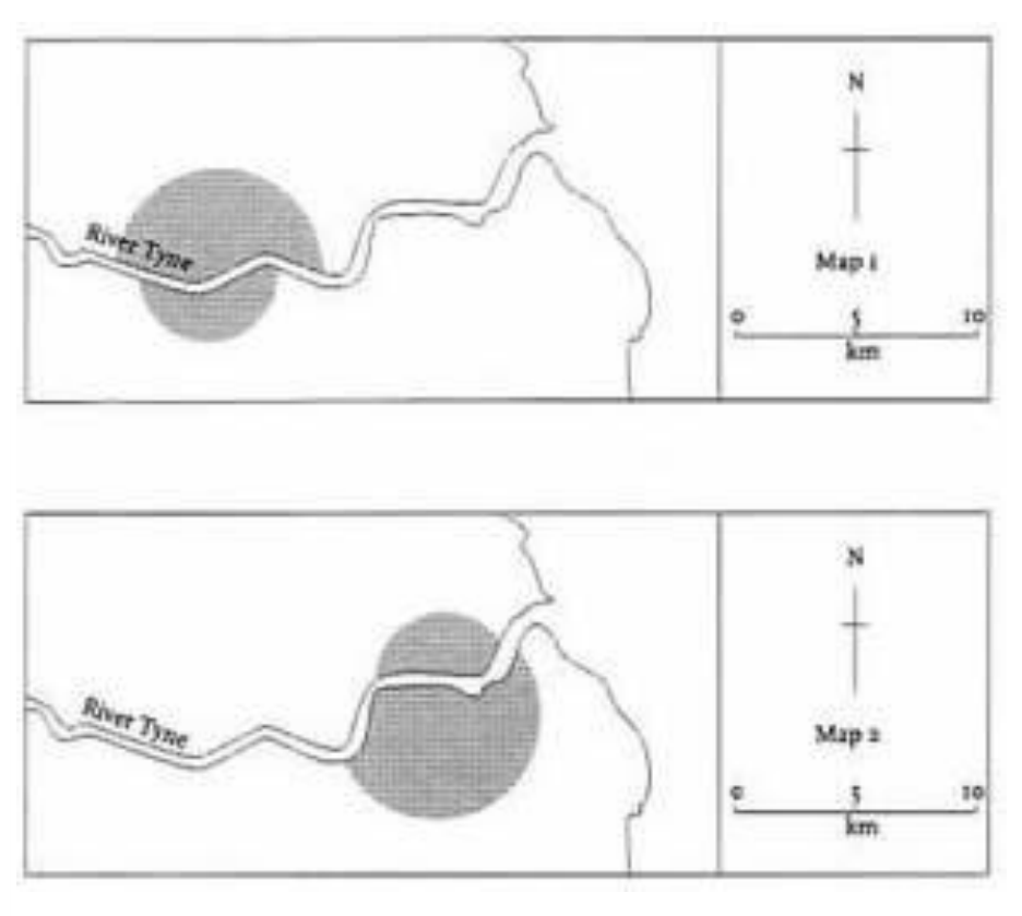
3. Newcastle is at the lowest bridging point on the Thyne, and stands on its northern bank. The city covers a roughly semi-circular area extending for four kilometres in all directions. Across the river lies Newcastle's twin - Gateshead - covering about half the area of Newcastle.
Which map fits the description in the text? (analysing maps)
a. Map 1
b. Map 2
c. Both maps
d. Neither of the two maps
Отговори
- 1. a
- 2. b
- 3. a
Решение
Theme Maps
- a
- b
- a
Оригинал в Архива: 1996MMTquestions.pdf · официални решения: 1996MMTanswers.pdf