iGeo 2015, Теренна работа — Задача 1.4. Fieldwork Exercise 1 — Task 1.4
Fieldwork Exercise 1 — Task 1.4 · 4 т.
Бележка от източника
The task requires comparison with the on-site view in 2015. The official marking review states that contemporary photographs were provided to markers, but those photographs and a completed model map are not included in the archived task, guidance or review. Both historical photographs, the original mapping template and the complete task-specific rubric are retained.
Условие
TIME LIMIT 30 MINUTES. 4 MARKS MAXIMUM
Look at the two historic photographs (Figs. 1, 2) of Staritsa taken in the summer of 1910. The photographs were taken from near where you now stand. Compare the photographs with the present-day view, and then complete the mapping task using the instructions on the following pages.
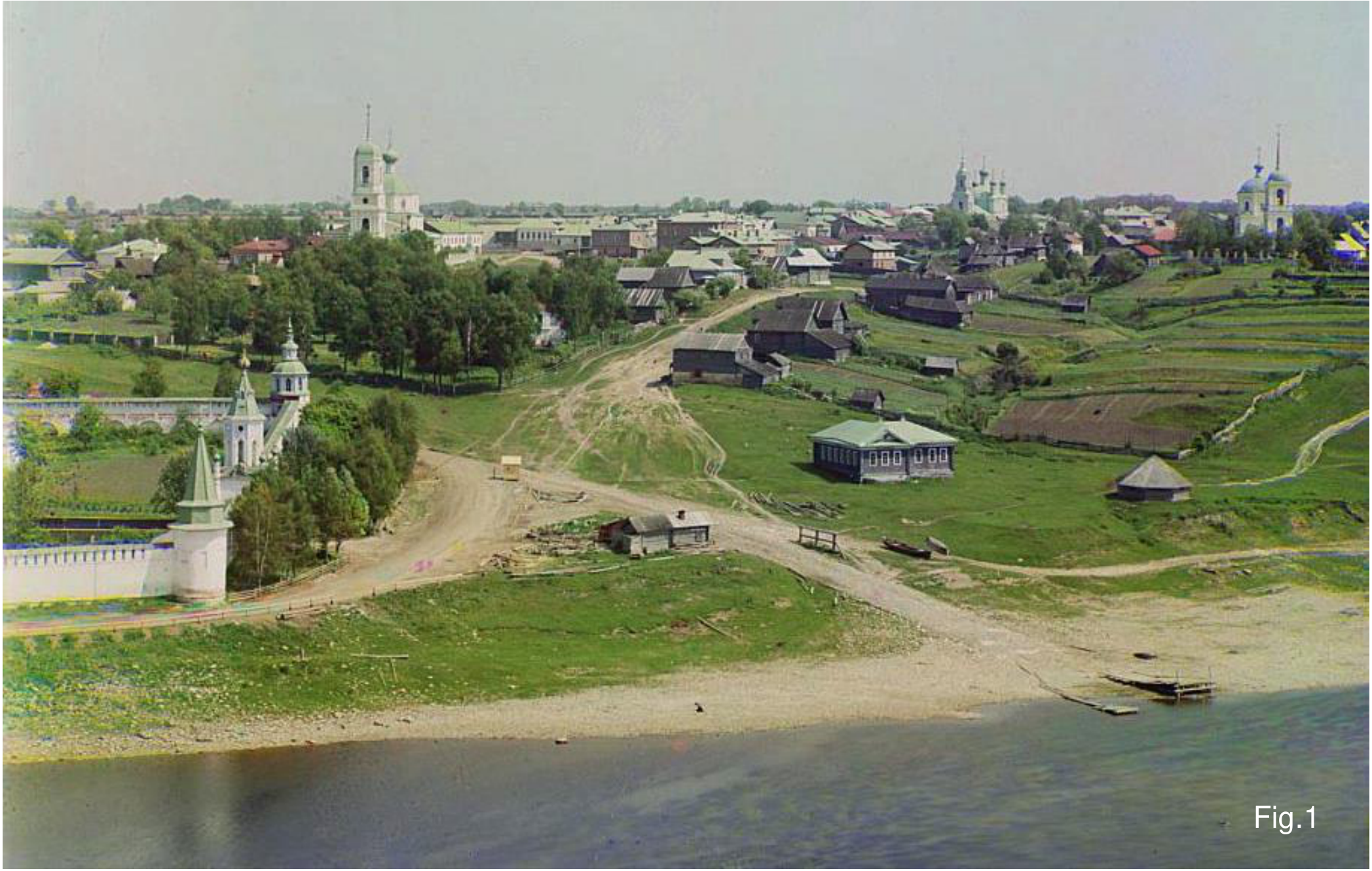
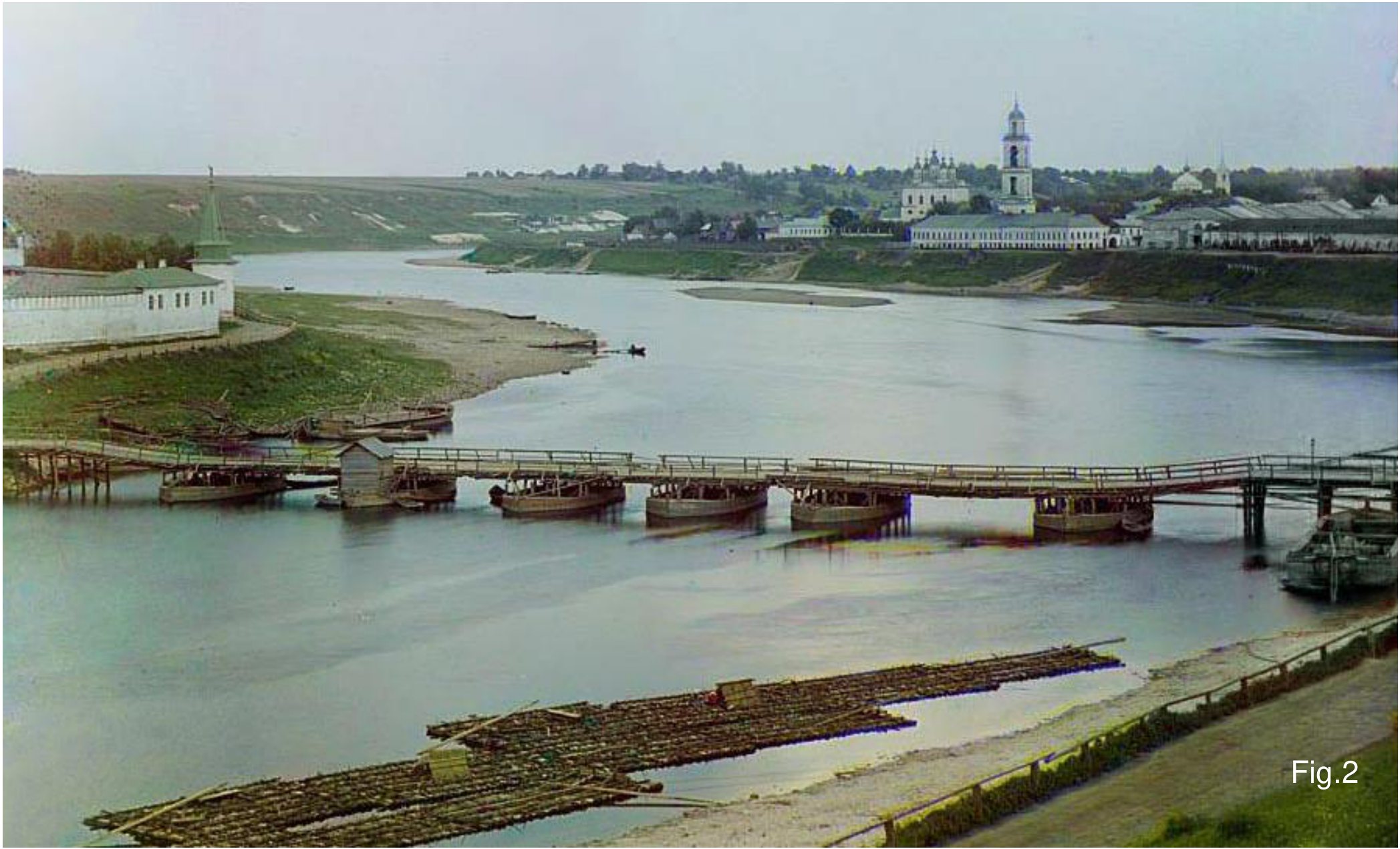
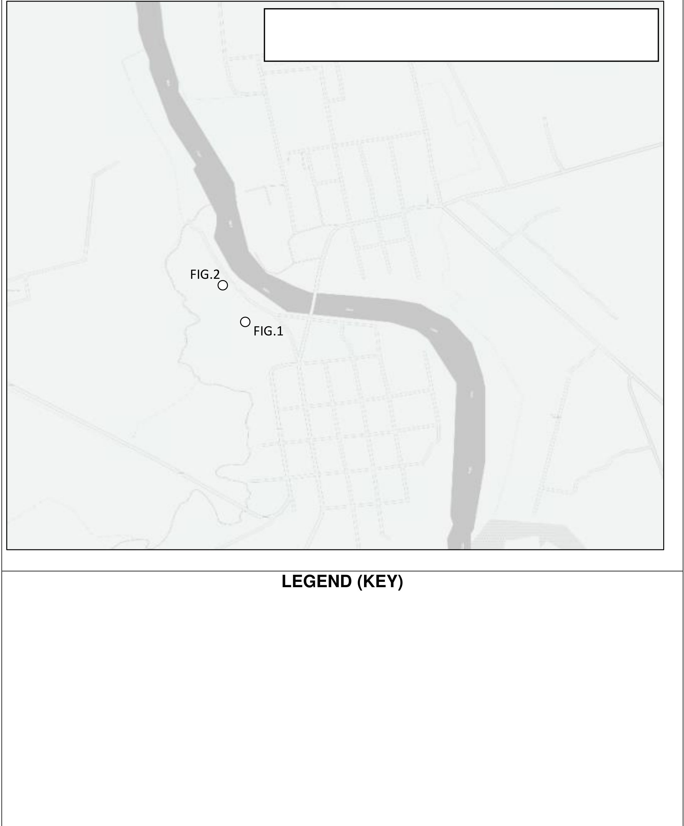
On the template below, map and label two areas of significant change in land or river use since 1910. In addition, use symbols to show locations where four features have either appeared or disappeared.
HINTS
- Using compasses if necessary, map and provide a key or legend only for the two areas of significant change and the four features.
- Provide a map title and key or legend.
GUIDANCE FOR FWE 1
IGEO 2015 FIELDWORK 1
| Name | Number | Team |
|---|---|---|
| __________________ | __________________ | __________________ |
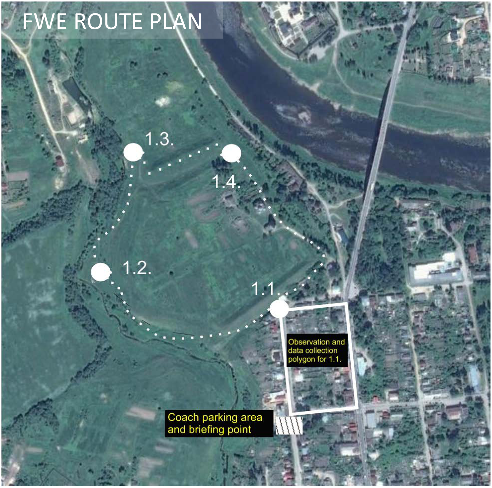
You are now in the central part of Staritsa, an historical settlement of the Tver oblast. Staritsa will be the venue for today’s field exercise. Please read the following notes carefully and follow all the instructions provided. Start by completing the header of this sheet with your personal data (given and family names, student number and team). Today’s exercise consists of four stages and you have to pass through all stages in order. For the exercise, you will work in groups of 40 participants, all from different countries. Do not attempt to change groups. Remain with your group at all times; volunteers will guide you, and you must follow all their instructions. If you have any sort of emergency, please ask for help from the volunteers. You may make additional notes in the space provided on the back of this sheet before you leave each stage. At each stage, you will receive a task sheet to complete and instruments to use (if necessary). At each stage you have 5 minutes to complete the front sheet and read the task, and then 30 minutes for observations and completing your answer. Please note that mobile phones, tablets or other means of communication are strictly prohibited during fieldwork. All violations of this rule will result in a penalty score. Take care at all times in the field; stay away from dangerous slopes.
FWE ROUTE PLAN
PLEASE USE THE OTHER SIDE OF THIS SHEET FOR YOUR INDIVIDUAL NOTES
INDIVIDUAL NOTES
Решение
Внимание: Непълно решение
The task requires comparison with the on-site view in 2015. The official marking review states that contemporary photographs were provided to markers, but those photographs and a completed model map are not included in the archived task, guidance or review. Both historical photographs, the original mapping template and the complete task-specific rubric are retained.
FWE1/4 (marked out of 4)
Marking jury: Marek Barwinski and Liudmila Fakeyeva
Contemporary photographs taken at the sites were made available, as the markers had not visited site 4. There were 6 things to mark: 2 areas and 4 features. If there were more things mapped, marks for the best ones (2 and 4) were awarded only. Only correctly mapped (over 50% overlap for areas and correctly located features recognized), annotated elements can score full mark.
Areas: Two areas worth 1 mark each (2 marks max.) Markers scored the two best areas mapped; they needed to be correctly located on the map. There must be an entry in the key, otherwise half a mark only. The typical areas were the gardening area (middle right of figure 1) or the carpark (left foreground). In Figure 2, the Volga interfluve (left distance) and the loading beach (in foreground) were also be acceptable.
Features: Four features worth .5 marks each (2 marks max.) The two bridges (one had disappeared and a new one was built) were features that were mapped and annotated in the key. Appeared: new bridge, war memorial, new houses, new infrastructure (roads, chimneys indicating different industries etc. Disappeared: churches (2), old bridge, marketplace, wooden floats etc.
Comments: This exercise was quite hard to mark, and students generally received the benefit of doubt. The outcome was that the task was quite discriminating with modest mean and quite high standard deviation.
Statistics
| Min | Max | Mean | Std |
|---|---|---|---|
| 0.0 | 4.0 | 2.19 | 1.07 |
Оригинал в Архива: 2015FWE1task4.pdf · официални решения: 2015FWEMarking.pdf · допълнителни данни: 2015FWE1guidance.pdf