iGeo 2015, Теренна работа — Задача 2. Task 2.2. Functional zones in Staritsa
12th International Geography Olympiad. FIELDWORK EXERCISE 2. Staritsa and sustainable settlement systems (Tasks 2.1 - 2.3). Tver 2015 · 8 т.
Указания
All tasks must be completed individually, using the answer templates provided.
The Resource Book provides important supporting materials.
Time management:
- You may have ten minutes to read the paper and Resource Book. No writing in this time.
- Students with English as the language of instruction then have two hours to complete the test.
- All other students have two hours and 20 minutes.
Write your answers in pen.
You may use coloured pencils/pens for map work or diagrams.
You may refer to material in the Resource Book in your answers, and you may use material included in earlier answers you have provided.
Условие
Task 2.2. Functional zones in Staritsa (maximum 8 marks)
2.2.1 Present-day land uses
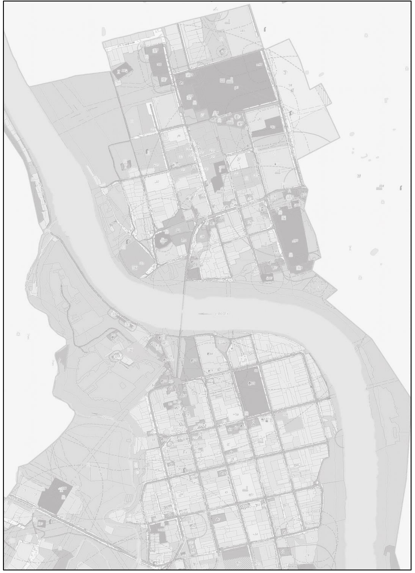
Examine the detailed map of land uses associated with each site mapped in the Staritsa area. This map was prepared in 2010 for the most recent Town Plan (page 9 of Resource Book). Compare the land uses of the two parts (right and left banks) of Staritsa. In each of the answer templates, provide three examples of common features, three features found only on the right bank, and three features found only on the left bank. Use your observations from FWE1 to and the resources provided.
| Common features |
|---|
Features found only on…
| …right (North) bank | …left (South) bank |
|---|---|
2.2.2 Zoning map
Zoning maps are often used in planning for sustainable development; they are the basis for making strategic decisions about parts of Staritsa that may be considered appropriate for particular activities. For example, future school or education zones can be located near recreational areas, food markets can be centrally located, and heritage zones can be protected. The map you make in this answer will help you answer Task 2.3, where you have to explain the geography behind the sustainable development initiative you propose for Staritsa.
On the Map Template 2, generalise and map the land uses into main six zones for the town’s development. You may have more than one instance of a zone type on your map; for example, there could be several “residential areas”, “areas zoned for industrial uses”, “heritage and protected areas”. You can indicate difference with overlayed symbol if this is necessary.
You may use brief map annotations if this helps to explain your zoning map. In making your map, use town blocks as your starting point. Provide a brief explanation of principles used for each zone allocation.
Map Template 2
| Zone (symbol and annotation) | Description and principles (criteria) behind allocation |
|---|---|
Решение
FWE2/2 (marked out of 8)
Marking jury: Birgit Justesen and Piret Pungas-Kohv
- Two marks were available for the table; a maximum of 1 mark for three common features (e.g. housing, schools, heritage sites), and 1 mark for three specific features for each bank (e.g. active monastery, industrial sites versus original site). For one or more acceptable answer in both bank-specific features, 0.5 marks can be awarded.
- Six marks were available for the map. Four marks were available for obligatory zones that included good key descriptions including sub-classification comment. An obligatory category (residential, industrial, heritage/protection and recreational), well described score 1 mark. Six additional zones, each worth half a mark scored .5 mark each.
Comments: This was the most time-consuming question to mark. On the other hand, most students scored quite well on this question
Statistics
Min 0.5 Max 7.5 Mean 4.16 Std 1.68
Оригинал в Архива: 2015FWE2task.pdf · официални решения: 2015FWEMarking.pdf