iGeo 2019, Теренна работа, задача 1 — Задача 1. Land Use Mapping

16th International Geography Olympiad. Hong Kong, China. 30 July – 5 August 2019. FIELDWORK EXERCISE. Task 1 · 30 юли 2019 г. · 40 т.

Условие

Time allowed: 120 minutes. Complete question 1.1. [Total Score: 40]

This question paper and its appendix contain a total of 8 pages.

You are now at fieldwork station ST1 or PtA (see Map 1a). At the end of this session, submit your (i) question paper, (ii) Map 1a; (iii) Draft Map and (iv) Map 2 at station ST1 or ST2 (PtA is not a station; see Map 1a, Figure A4 and A5). Make sure you have written your name and student number in the spaces provided on the question paper and maps. Late submissions will not be accepted.
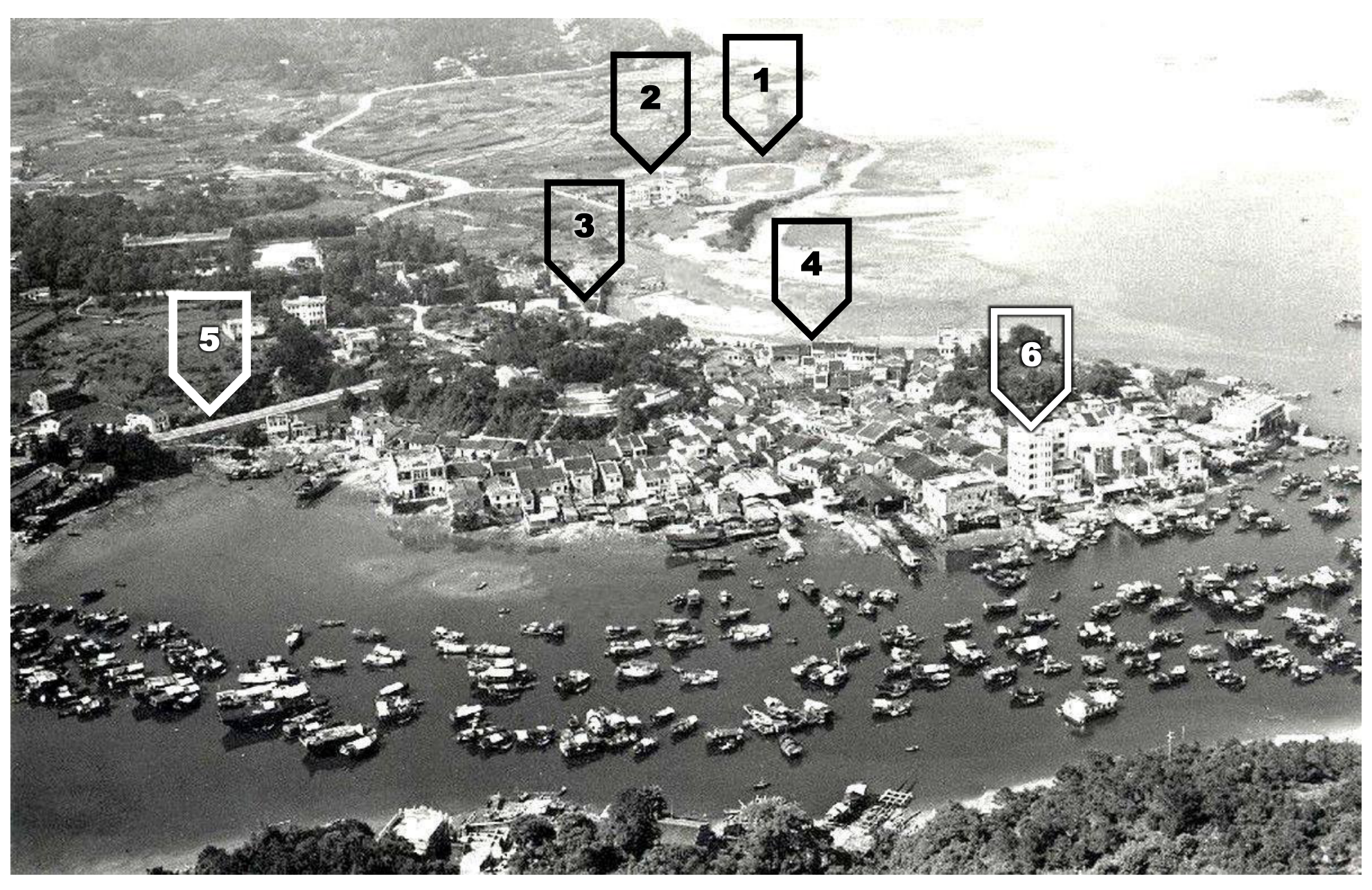
Black-and-white aerial photograph of Sai Kung Town in 1967 with a harbour full of boats in the foreground and markers numbered 1 to 6 placed over the town.
Figure A1: Sai Kung Town, 1967. 1: Sports ground; 2: Police station, 3: Tin Hau Temple; 4: Yi Chun Street nowadays; 5: Hiram’s Highway nowadays; 6: Kat Cheung Building.
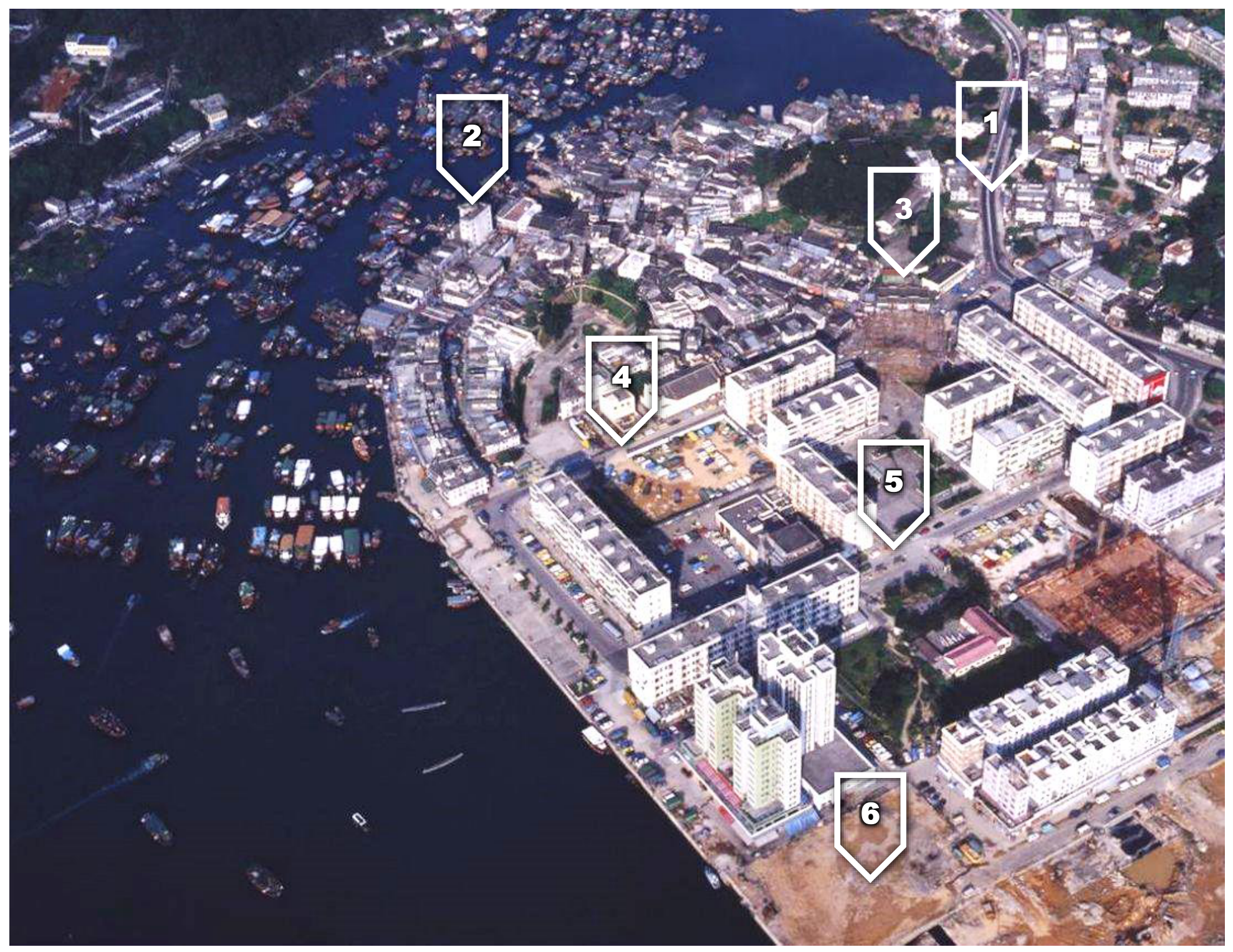
Colour aerial photograph of Sai Kung Town in 1983 showing the harbour with boats on the left and blocks of residential buildings on the right, with markers numbered 1 to 6.
Figure A2: Sai Kung Town, 1983. 1: Hiram’s Highway; 2: Kat Cheung Building; 3: Tin Hau Temple; 4: Yi Chun Street; 5: Man Nin Street; 6: Light bus terminal nowadays. New residential buildings on the right foreground were built in 1975 to cater for resettlement due to the construction of High Island Reservoir.
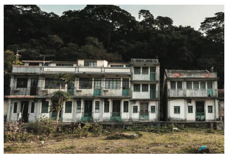
Photograph of weathered two- to three-storey traditional village houses with balconies in front of a wooded hillside.
Figure A3: Photos of Housing Units of Hong Kong Over Time: (a) Traditional village house units of the post-war period
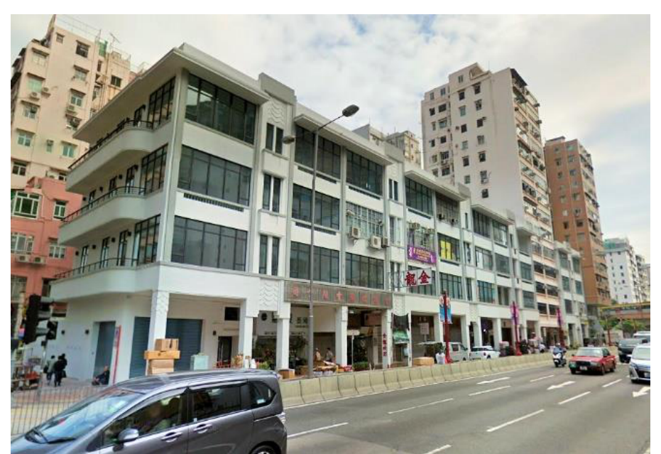
Photograph of a refurbished four-storey white Chinese-style building with shops at street level along a road, taller residential towers behind.
(b) Refurbished pre-war Chinese-style flat.
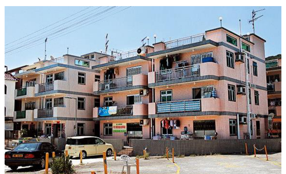
Photograph of pink-tiled three-storey village houses with balconies and cars parked in front.
(c) Typical village house unit built after 1972. Floor area 700 feet2^{2}, 3-storey.
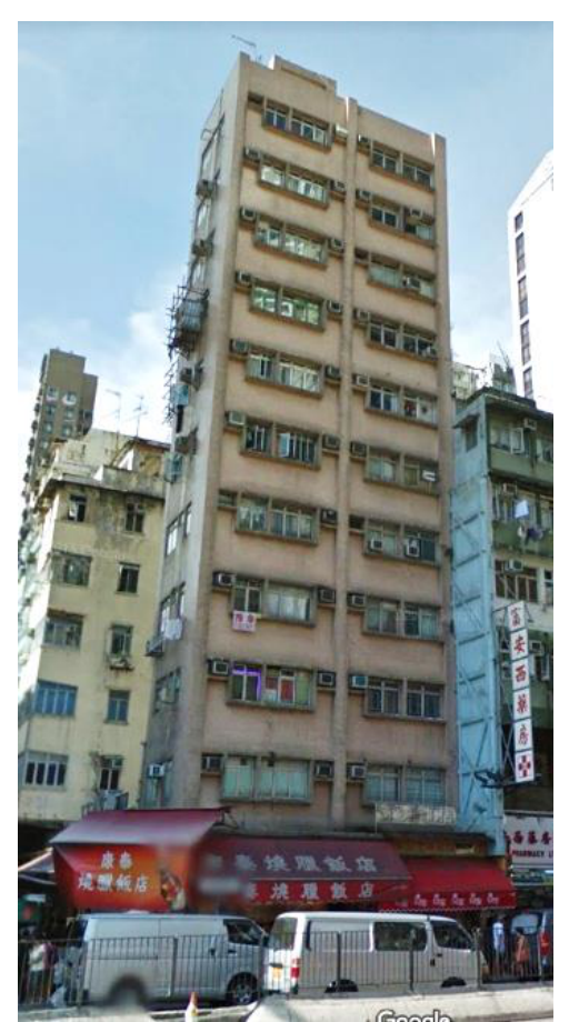
Photograph of a narrow, plain, tall residential building of the 1970s with shop signs at street level.
(d) Building of the 1970s having an utilitarian architecture1^{1}. Usually less than 20-storey.
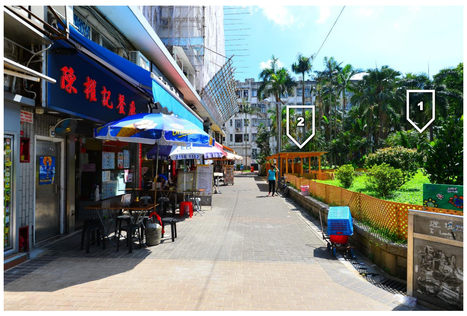
Colour photograph of a paved street with a restaurant and umbrellas on the left and a garden with palm trees on the right; markers 1 (Sha Tsui Playground) and 2 (ST2 under the orange pavilion).
Figure A5: Fieldwork Station ST2. 1: Sha Tsui Playground; 2: ST2 under the orange pavilion.

1.1 For all transects (purple line) as shown in Map 1a, identify the following features:

  • Building types and building height (in number of storey)
  • Ground floor retail services and restaurants types

Summarise your observations on Map 2.

Helpful hints:

You will draft your data collection on the draft map sheet provided. Later you will organise and annotate your observations on Map 2. Map 2 is the only page that will be graded. A score will be awarded for:

  • The accuracy of data collected;
  • The design of a classification scheme; and
  • Clarity of presentation.

Attention should be paid to the target customers of specific shops/ restaurants as well as to whether clusters exist. If so, where and why do they occur? This information is important to the test that follows.

  • END OF PAPER -

Appendix

1^{1} Building design to maximize utility, or in other words, the efficiency of the use of space, light and construction materials.
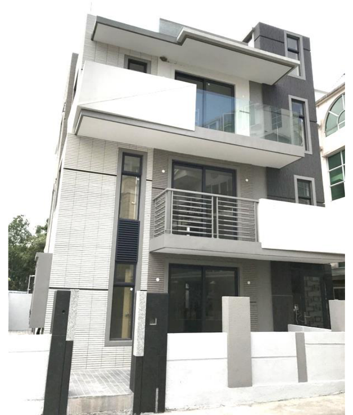
Photograph of a modern grey-and-white three-storey village house with balconies and glass railings.
(e) Village house built in 2010s. Having a modern architecture. Floor area 700 feet2^{2}, 3-storey.
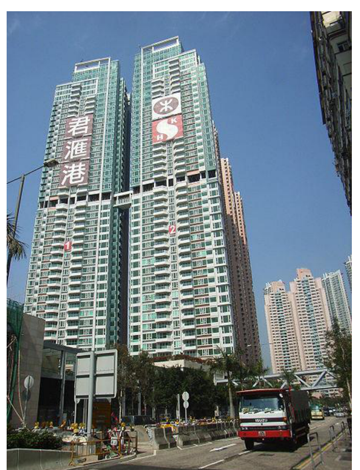
Photograph of twin modern high-rise residential towers with bay windows, a road and a truck in the foreground.
(f) Modern building2^{2} of the 2000s. 20-storey upwards but subject to local land use plan.

2^{2} Façade (outward appearance) of a modern building in Hong Kong usually display the building’s technical and functional components, such as having large bay windows and balconies. The façade of a modern building therefore looks more varied compared to those built in the 1970s.
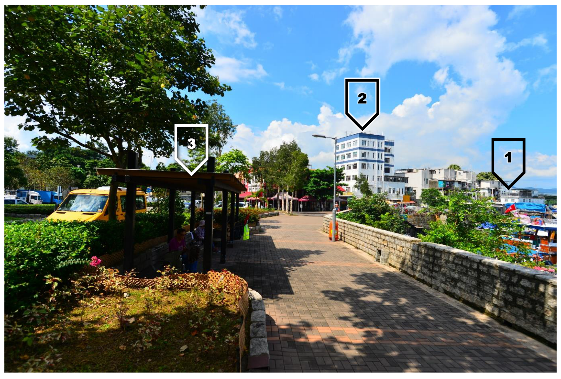
Colour photograph of a paved waterfront promenade with a shelter on the left and a low stone wall on the right; markers 1 (typhoon shelter), 2 (Kat Cheung Building) and 3 (ST1).
Figure A4: Fieldwork Station ST1. 1: Typhoon shelter; 2: Kat Cheung Building; 3: ST1.

Решение

Внимание: Непълно решение

В архива няма официално решение на тази задача.


Оригинал в Архива: FWE_Task1_QP.pdf